Geolocate

Bricia topographic map

Click on the map to display elevation.

About this map

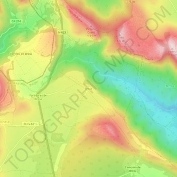
Name: Bricia topographic map, elevation, terrain.

Location: Bricia, Alfoz de Bricia, Burgos, Castile and León, Spain (42.89502 -3.83934 42.93502 -3.79934)

Average elevation: 979 m

Minimum elevation: 781 m

Maximum elevation: 1,179 m

Gear up for your next adventure:

🛶Kayak Accessories - Essential gear for safe and fun kayaking adventures
🧭GPS Outdoor Watch - Smart watch for navigation and fitness tracking in nature
🧥Packable Rain Jacket - Breathable waterproof layer for unpredictable weather
🥾Waterproof Hiking Boots - Boots keeping your feet dry in wet conditions
🧼Travel Hand Sanitizer - Keep hands clean when water is scarce

As an Amazon Associate, this site earns from qualifying purchases at no extra cost to you.