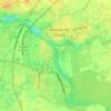
Ávila topographic map
Click on the map to display elevation.
Ávila
Ávila is the capital and most populated municipality of the Province of Ávila, located in the autonomous community of Castile and León in Spain. Located in the centre of the Iberian Peninsula, to the north of the Sistema Central, it lies on the right bank of the Adaja and, at an elevation of over 1,130 metres (3,710 ft) above sea level, is the highest provincial capital in Spain.
About this map

Name: Ávila topographic map, elevation, terrain.
Location: Ávila, Castile and León, 05001, Spain (40.49648 -4.86022 40.81648 -4.54022)
Average elevation: 1,167 m
Minimum elevation: 809 m
Maximum elevation: 1,923 m
Other topographic maps
Click on a map to view its topography, its elevation and its terrain.


Valladolid
Valladolid is located at roughly 735 metres above sea level, at the centre of the Meseta Norte, the plateau drained by the Duero river basin covering a major part of the Northwest of the Iberian Peninsula. The primitive urban core was built ex novo in the 11th century on a small elevation near the confluence…
Average elevation: 768 m
Salamanca
With an altitude of over 800 meters, Salamanca has a warm-summer Mediterranean climate (Csb) according to the Köppen climate classification, with some cold semi-arid climate (BSk) climatic influences, resulting in large diurnal temperature variations, with hot summers and chilly winters, and nearly-semi-arid…
Average elevation: 812 m


Burgos
At an elevation of 865 metres (2,838 ft), the city of Burgos lies in the transition zone between a Warm-summer Mediterranean climate (Köppen Csb) and an Oceanic climate (Köppen Cfb), with some continental influence resulting from its distance from the sea and higher altitude. Burgos' climate features chilly…
Average elevation: 907 m

Segovia
Segovia is one of nine provinces that make up the autonomous region of Castile and León. Burgos and Valladolid lie to the north, Ávila to the west, Madrid to the south, and Soria to the east. The altitude of the province varies from 750 metres (2,461 feet) in the extreme northwest to a maximum of 2,430 m…
Average elevation: 1,143 m

Briviesca
On Tuesday of Holy Week, after the afternoon mass, a Penitential Way of the Cross is celebrated through the streets of the city with three processions: "The Nazarene", "The Holy Christ of the Atonement", and "The Solitude of Our Lady", followed by the Bugle and Drum Band, created in 2012. After the mass,…
Average elevation: 793 m



Arévalo
It is located at an altitude of 820 meters and is near the junction of the two rivers Adaja and Arevalillo. Its encompassed area is 46.07 km2.
Average elevation: 845 m



Benavente
Benavente is characterized by a cold semi-arid climate in the Köppen climate classification (BSk) with continental influences due to the altitude of the municipality and its distance to the sea. The amount of winter frosts is increased, taking place even in spring, with consequential damage to some of the…
Average elevation: 716 m


Briviesca
On Tuesday of Holy Week, after the afternoon mass, a Penitential Way of the Cross is celebrated through the streets of the city with three processions: "The Nazarene", "The Holy Christ of the Atonement", and "The Solitude of Our Lady", followed by the Bugle and Drum Band, created in 2012. After the mass,…
Average elevation: 793 m















Espinosa de los Monteros
Picón Blanco is a high mountain peak located in the municipality at an elevation of 1512 m. The road from Arredondo to the abandoned military base at the top is a climb in professional road bicycle racing, having been often used in Vuelta a Burgos and twice at Vuelta a España . It is 7.9 kilometres long at…
Average elevation: 1,001 m



Valladolid
Valladolid is located at roughly 735 metres above sea level, at the centre of the Meseta Norte, the plateau drained by the Duero river basin covering a major part of the Northwest of the Iberian Peninsula. The primitive urban core was built ex novo in the 11th century on a small elevation near the confluence…
Average elevation: 768 m

Valladolid
Valladolid is located at roughly 735 metres above sea level, at the centre of the Meseta Norte, the plateau drained by the Duero river basin covering a major part of the Northwest of the Iberian Peninsula. The primitive urban core was built ex novo in the 11th century on a small elevation near the confluence…
Average elevation: 768 m

Vega de Valcarce
Spain > Castile and León > El Bierzo
Vega de Valcarce (Veiga de Valcarce in Leonese language) is a village and municipality located in the region of El Bierzo (province of León, Castile and León, Spain) . According to a census (INE), the municipality has a population of 555 inhabitants. The mayoress is María Luisa González Santín. The…
Average elevation: 1,004 m
Benavente
Benavente is characterized by a cold semi-arid climate in the Köppen climate classification (BSk) with continental influences due to the altitude of the municipality and its distance to the sea. The amount of winter frosts is increased, taking place even in spring, with consequential damage to some of the…
Average elevation: 716 m
Burgos
At an elevation of 865 metres (2,838 ft), the city of Burgos lies in the transition zone between a Warm-summer Mediterranean climate (Köppen Csb) and an Oceanic climate (Köppen Cfb), with some continental influence resulting from its distance from the sea and higher altitude. Burgos' climate features chilly…
Average elevation: 907 m
Palencia
The region of Palencia has a Continental Mediterranean climate with cool winters, due to altitude (749 m) and isolation from maritime influences, chilly winds, including some days of snow in the winter and minimum temperatures usually below 0 °C (32 °F). Fog is frequent because of the Carrion river. Summers…
Average elevation: 794 m




Ávila
Ávila's position results in a temperate Mediterranean climate (Csb, according to the Köppen climate classification), with warm summers and chilly winters with snowfalls, bordering on a cold semi-arid climate (BSk). The hottest month, July, has an average temperature of 20.6 °C (69 °F), and the coldest…
Average elevation: 1,157 m
Salamanca
The city is located at an altitude of 800 meters above sea level. The altitude of the municipality varies from 911 meters (Los Montalvos), in the southwest, and 763 meters in the last stretch in the municipality of the Tormes river.
Average elevation: 812 m
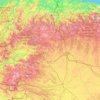
León
As for the temperatures, in general it is a cold climate due to the altitude and the abundance of frost (which persist from November to May), being more intense in the mountainous areas reaching -18 °C. Vega de Liordes, an enclave in the León sector of Picos de Europa belonging to the municipality of Posada…
Average elevation: 913 m