Geolocate

El Coto topographic map

Click on the map to display elevation.

About this map

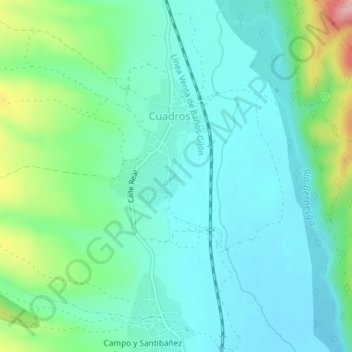
Name: El Coto topographic map, elevation, terrain.

Location: El Coto, Cuadros, León, Castile and León, 24122, Spain (42.69648 -5.64842 42.71648 -5.62842)

Average elevation: 917 m

Minimum elevation: 877 m

Maximum elevation: 1,048 m

Gear up for your next adventure:

🧢Hiking Sun Hat - Wide-brimmed protection for exposed mountain ridges
🧊Insulated Water Bottle - Keeps drinks cold in summer and prevents freezing in winter
🔨Vehicle Emergency Tool - Safety tool for remote road trips to trailheads
🛶Waterproof Dry Bags - Keep electronics and clothes dry during river crossings
🥘Camping Cookware Set - Compact nesting pots and pans for trail cooking

As an Amazon Associate, this site earns from qualifying purchases at no extra cost to you.