Geolocate

Guímara topographic map

Click on the map to display elevation.

About this map

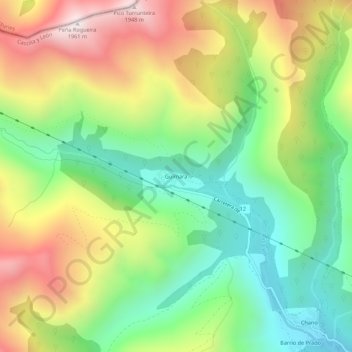
Name: Guímara topographic map, elevation, terrain.

Location: Guímara, Peranzanes, El Bierzo, León, Castile and León, Spain (42.87930 -6.70969 42.91930 -6.66969)

Average elevation: 1,370 m

Minimum elevation: 956 m

Maximum elevation: 1,948 m

Gear up for your next adventure:

🧰Survival Kit - Essential gear for emergencies in the wilderness
💧Reusable Water Bottle - Durable water bottles for hydration on trails
🥾Hiking Gaiters - Protect legs and shoes from mud, snow, and debris
🩹Moleskin Blister Pads - Direct protection for painful foot pressure points
🥾Hiking Boots - Sturdy boots providing ankle support and traction on rugged trails

As an Amazon Associate, this site earns from qualifying purchases at no extra cost to you.