Geolocate

León topographic map

Click on the map to display elevation.

About this map

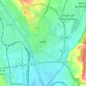
Name: León topographic map, elevation, terrain.

Location: León, Castile and León, Spain (42.57335 -5.59997 42.62319 -5.55524)

Average elevation: 838 m

Minimum elevation: 810 m

Maximum elevation: 936 m

Gear up for your next adventure:

🥾Trail Running Shoes - Lightweight and durable shoes for trail running
Camping Coffee Maker - Brew fresh coffee anywhere on the topographic map
🗺️Topographic Maps - Detailed maps to explore trails, mountains, and wilderness areas
🧴First Aid Kit - Essential first aid supplies for outdoor emergencies
🧥Waterproof Hiking Jacket - Protect yourself from rain and wind while hiking

As an Amazon Associate, this site earns from qualifying purchases at no extra cost to you.