Geolocate

Lugueros topographic map

Click on the map to display elevation.

About this map

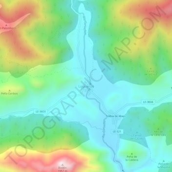
Name: Lugueros topographic map, elevation, terrain.

Location: Lugueros, Valdelugueros, León, Castile and León, 24843, Spain (42.95312 -5.43239 42.99312 -5.39239)

Average elevation: 1,394 m

Minimum elevation: 1,156 m

Maximum elevation: 1,938 m

Gear up for your next adventure:

🔋Emergency Crank Radio - Weather alerts and power without needing batteries
🧤Rechargeable Heated Gloves - Extreme warmth for Canadian winter expeditions
🧴Insect Repellent - Protect yourself from bugs during outdoor adventures
🧭Orienteering Kit - Tools for map reading and navigation in the wild
Camping Coffee Maker - Brew fresh coffee anywhere on the topographic map

As an Amazon Associate, this site earns from qualifying purchases at no extra cost to you.