Baran topographic map
Click on the map to display elevation.
Baran
Baran is located at 25°06′N 76°31′E / 25.1°N 76.52°E / 25.1; 76.52. It has an average elevation of 262 metres (859 feet). Located in the Kota Plateau of Vindhya range, district is the location of famous Ramgarh crater made from the meteorite strike.
About this map

Name: Baran topographic map, elevation, terrain.
Location: Baran, Rajasthan, India (24.40325 76.19846 25.43833 77.42662)
Average elevation: 333 m
Minimum elevation: 198 m
Maximum elevation: 569 m
Other topographic maps
Click on a map to view its topography, its elevation and its terrain.
Udaipur
India > Rajasthan > Girwa Tehsil
Udaipur is located at 24°31′30″N 73°40′38″E / 24.525049°N 73.677116°E / 24.525049; 73.677116. The city covers an area of 64 km2 (25 sq mi) and lies at an altitude of 598.00 m (1,962 ft) above sea level. It is located in the southern region of Rajasthan, near the Gujarat border. The city…
Average elevation: 656 m

Udaipur
India > Rajasthan > Girwa Tehsil
Udaipur is located at 24°31′30″N 73°40′38″E / 24.525049°N 73.677116°E / 24.525049; 73.677116. The city covers an area of 64 km2 (25 sq mi) and lies at an altitude of 598.00 m (1,962 ft) above sea level. It is located in the southern region of Rajasthan, near the Gujarat border. The city…
Average elevation: 656 m

Rawatbhata
India > Rajasthan > Rawatbhata Tehsil
Rawatbhata is located at 24°56′N 75°35′E / 24.93°N 75.58°E / 24.93; 75.58. It has an average elevation of 325 metres (1066 feet).
Average elevation: 352 m



Sagwara
India > Rajasthan > Sagwara Tehsil
Sagwara is located in the east-central Dungarpur district, in Sagwara Tehsil. It has an average elevation of 244 metres (801 ft). Sagwara is famous for its sculpture, marble carving, temple architecture and gold jewelry. It is a major trading hub for nearby villages.
Average elevation: 177 m
Bikaner
India > Rajasthan > Bikaner Tehsil
Around a century after Rao Bika founded Bikaner, the state's fortunes flourished under the sixth Raja, Rai Singhji, who ruled from 1571 to 1611. During the Mughal Empire's rule in the country, Raja Rai Singh accepted the suzerainty of the Mughals and held a high rank as an army general at the court of the…
Average elevation: 225 m

Balotra
India > Rajasthan > Pachpadra Tehsil
Balotra is located at 25°50′N 72°14′E / 25.83°N 72.23°E / 25.83; 72.23. It has an average elevation of 106 metres (347 feet).
Average elevation: 124 m

Deshnoke
India > Rajasthan > Bikaner Tehsil
Deshnoke is located at 27°47′26″N 73°20′27″E / 27.79056°N 73.34083°E / 27.79056; 73.34083. It has an average elevation of 265meters (869feet). It is served by Deshnoke Railway station.
Average elevation: 272 m
Rani
India > Rajasthan > Rani Tehsil
Rani is located at 25°22′N 73°18′E / 25.37°N 73.3°E / 25.37; 73.3.[3] It has an average elevation of 273 metres (895 feet).
Average elevation: 279 m


Mundwa
India > Rajasthan > Mundwa Tehsil
Mundwa is located at 27°04′N 73°49′E / 27.07°N 73.82°E / 27.07; 73.82. It has an average elevation of 335 metres (1099 feet). There are four Talabs on all the four directions of Mundwa. Names of these Talabs are
Average elevation: 332 m








Suratgarh
India > Rajasthan > Suratgarh Tehsil
Suratgarh is located at 29°19′04″N 73°53′56″E / 29.317701°N 73.898935°E / 29.317701; 73.898935. It has an average elevation of 168 metres (551) feet. It is a Northern Part of Thar desert. Seasonal Ghaghar river runs through Northern part of tehsil. Suratgarh has Greenary in Northern part…
Average elevation: 177 m






Haldighati Park
India > Rajasthan > Sanganer Tehsil > Jaipur Municipal Corporation
Average elevation: 372 m

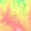
Baran
India > Rajasthan > Baran Tehsil
Baran is located at 25°06′N 76°31′E / 25.1°N 76.52°E / 25.1; 76.52. It has an average elevation of 262 metres (859 ft). It is surrounded by three Rivers Kalisindh, Parvati and Parban. The city is situated on the border of Rajasthan and Madhya Pradesh.
Average elevation: 264 m