Geolocate

Jodhpur topographic map

Click on the map to display elevation.

About this map

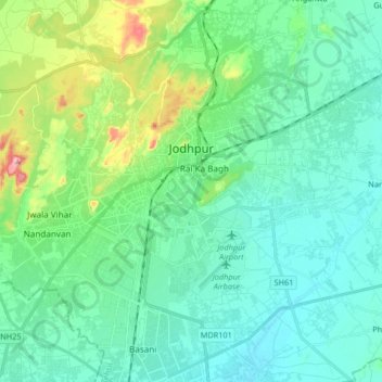
Name: Jodhpur topographic map, elevation, terrain.

Location: Jodhpur, Jodhpur Tehsil, Jodhpur District, Rajasthan, India (26.20598 72.94858 26.35367 73.08887)

Average elevation: 238 m

Minimum elevation: 197 m

Maximum elevation: 398 m

Other topographic maps

Click on a map to view its topography, its elevation and its terrain.

Jodhpur Tehsil

India > Rajasthan > Jodhpur Tehsil

Average elevation: 225 m

Gear up for your next adventure:

🛶Kayak Dry Bag - Waterproof storage for kayaking adventures
💧Reusable Water Bottle - Durable water bottles for hydration on trails
💧Hydration Bladder - Hands-free hydration solution for long treks
🧦Thermal Socks - Warm socks for winter hiking or camping
🚲MTB Frame Bag - Carry tools and maps directly on your bicycle frame

As an Amazon Associate, this site earns from qualifying purchases at no extra cost to you.