Geolocate

Bandrol topographic map

Click on the map to display elevation.

About this map

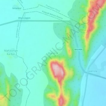
Name: Bandrol topographic map, elevation, terrain.

Location: Bandrol, Thanagazi Tehsil, Alwar, Rajasthan, India (27.41254 76.21733 27.45254 76.25733)

Average elevation: 471 m

Minimum elevation: 409 m

Maximum elevation: 699 m

Gear up for your next adventure:

🔦LED Headtorch - Bright and durable light for night activities
💡LED Camping Lantern - Illuminate your campsite with long-lasting lanterns
🩹Compact First Aid Kit - Pre-packed essentials for common trail injuries
🏃Hydration Running Vest - Carry water and maps close to your body for speed
💧Reusable Water Bottle - Durable water bottles for hydration on trails

As an Amazon Associate, this site earns from qualifying purchases at no extra cost to you.