Colombia topographic maps
Click on a map to view its topography, its elevation and its terrain.
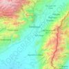
Valledupar
Valledupar is located southeast of the Sierra Nevada de Santa Marta. Its average temperature is 28 °C. Because of its relatively high altitude and proximity to the equator, it has a variety of environments, from warm heat to perpetual snow. Notable geographic features in Valledupar include the Sierra Nevada…
Average elevation: 1,087 m
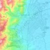
Cali
Colombia > Valle del Cauca > Cali
Under Köppen's climate classification, Cali features a dry-summer tropical savanna climate (Köppen climate classification: As), closely bordering a tropical monsoon climate (Köppen: Am). The Western Mountain Range rises from an average of 2,000 m (6,562 ft) above sea level in the northern part of the city…
Average elevation: 1,142 m
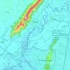
Cota
Cota is a municipality and town of Colombia in the Central Savanna Province of the department of Cundinamarca. Cota is part of the metropolitan area of Colombian capital Bogotá which centre is 26 kilometres (16 mi) away. The urban centre of Cota is located at an altitude of 2,566 metres (8,419 ft) and the…
Average elevation: 2,574 m
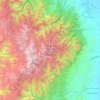
Sierra Nevada del Cocuy
The Sierra Nevada del Cocuy region corresponds to the highest elevations of the Eastern Cordillera of the Colombian Andes. The geologic origins of this mountain range are complex, but have been hypothesized to be the inversion of a Mesozoic extensional basin which gave way to a sedimentary basin that…
Average elevation: 2,041 m

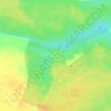
Centro Experimental Gaviotas
Gaviotas has leveraged many forms of solar energy. They developed solar heating panels to provide hot water, which were installed in Gaviotas homes and housing developments in Medellín. The original design was not suited for Bogotá, however, since at 2,600 meters of altitude (9,000 ft) the city has a cooler…
Average elevation: 176 m
Bogota, Capital District
Bogotá is located in the southeastern part of the Bogotá savanna (Sabana de Bogotá) at an average altitude of 2,640 meters (8,660 ft) above sea level. The Bogotá savanna is popularly called "savannah" (sabana), but constitutes actually a high plateau in the Andes mountains, part of an extended region known…
Average elevation: 2,183 m
Fusagasugá
It was founded in 1592 by Spanish priests. The town located some 56 kilometers from the capital, Bogotá; borders Pasca, Arbeláez, Tibacuy, Silvania and other municipalities of Sumapaz. Its elevation is 5,669 feet (1,728 m) above sea level, and the average temperature 20 °C (68 °F).
Average elevation: 2,130 m
Perímetro Urbano Cúcuta
Colombia > Norte de Santander > Cúcuta
The city is in the eastern part of the Department of North Santander, in the Cordillera Oriental, close to the border with Venezuela. The city's area is 110 square kilometres (42 square miles) and its elevation is 320 metres (1,050 feet) above sea level.
Average elevation: 314 m