
Thank you for supporting this site ❤️
Make a donation
Make a donation
Gear up for your next adventure:
As an Amazon Associate, this site earns from qualifying purchases at no extra cost to you.
Chucuní topographic map
Click on the map to display elevation.
Thank you for supporting this site ❤️
Make a donation
Make a donation
Gear up for your next adventure:
As an Amazon Associate, this site earns from qualifying purchases at no extra cost to you.
About this map
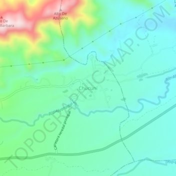
Name: Chucuní topographic map, elevation, terrain.
Location: Chucuní, Ibagué, Centro, Tolima, Colombia (4.44622 -75.07611 4.48622 -75.03611)
Average elevation: 745 m
Minimum elevation: 639 m
Maximum elevation: 1,076 m
Thank you for supporting this site ❤️
Make a donation
Make a donation
Gear up for your next adventure:
As an Amazon Associate, this site earns from qualifying purchases at no extra cost to you.