
Make a donation
Gear up for your next adventure:
As an Amazon Associate, this site earns from qualifying purchases at no extra cost to you.
Centro Experimental Gaviotas topographic map
Click on the map to display elevation.
Make a donation
Gear up for your next adventure:
As an Amazon Associate, this site earns from qualifying purchases at no extra cost to you.
Centro Experimental Gaviotas
Gaviotas has leveraged many forms of solar energy. They developed solar heating panels to provide hot water, which were installed in Gaviotas homes and housing developments in Medellín. The original design was not suited for Bogotá, however, since at 2,600 meters of altitude (9,000 ft) the city has a cooler climate and is often overcast. Therefore, engineers needed to figure out a way to concentrate diffused light. Inspired by a silica film with an ultra-oxidized layer that Gaviotas engineers studied in London, Alonso Gutiérrez stripped a copper sheet clean in a bath of nitric acid, rinsed it, then aggressively oxidized it by dipping it into a solution of copper sulfate dissolved in sulfuric and hydrochloric acids. The final result was a thick and deeply black film. Alonso estimated that it was even more effective than the British version and it worked remarkably well in accumulating heat even in cool, cloudy conditions. They also designed spherical water storage tanks to compress the greatest volume into the least amount of space. With the new design, Gaviotas was able to install solar heating collectors all over Bogotá, including 30,000 person Ciudad Tunal, at the time the largest public housing complex in the world to use only solar energy to heat its water.
Make a donation
Gear up for your next adventure:
As an Amazon Associate, this site earns from qualifying purchases at no extra cost to you.
About this map
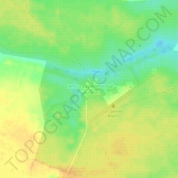
Name: Centro Experimental Gaviotas topographic map, elevation, terrain.
Location: Centro Experimental Gaviotas, Cumaribo, Vichada, Colombia (4.53433 -70.95051 4.57433 -70.91051)
Average elevation: 176 m
Minimum elevation: 158 m
Maximum elevation: 188 m
Make a donation
Gear up for your next adventure:
As an Amazon Associate, this site earns from qualifying purchases at no extra cost to you.