Geolocate

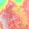
Putumayo topographic map

Click on the map to display elevation.

About this map

Name: Putumayo topographic map, elevation, terrain.

Location: Putumayo, RAP Amazonía, Colombia (-0.55315 -77.18680 1.46782 -73.84132)

Average elevation: 677 m

Minimum elevation: 152 m

Maximum elevation: 4,390 m

Other topographic maps

Click on a map to view its topography, its elevation and its terrain.
Río Nevado

Colombia > Boyacá > Guacamayas > El Espino

Average elevation: 2,677 m

Centro Experimental Gaviotas

Colombia > Vichada > Cumaribo

Gaviotas has leveraged many forms of solar energy. They developed solar heating panels to provide hot water, which were installed in Gaviotas homes and housing developments in Medellín. The original design was not suited for Bogotá, however, since at 2,600 meters of altitude (9,000 ft) the city has a cooler…

Average elevation: 176 m
Santo Domigo

Colombia > Boyacá > Cuítiva

Average elevation: 2,752 m

Chucuní

Colombia > Tolima > Ibagué

Average elevation: 745 m

16

Colombia > Cesar > Perímetro Urbano Valledupar

Average elevation: 164 m

Maseta

Colombia > Caldas > La Dorada

Average elevation: 209 m

Piedras Blancas - Matasano

Colombia > Antioquia > Medellín

Average elevation: 2,426 m

Timbó de Betania

Colombia > Vaupés > Mitú

Average elevation: 182 m

Gear up for your next adventure:

🧥Waterproof Pants - Keep dry during rainy hiking conditions
🥾Lightweight Hiking Boots - Boots for comfort and mobility on long hikes
🥾Light Trekking Boots - Supportive boots for multi-day treks
🥾Waterproof Trail Shoes - Shoes designed to handle wet terrain
🚲Handlebar Phone Mount - View topographic-map.com live while cycling

As an Amazon Associate, this site earns from qualifying purchases at no extra cost to you.