Geolocate

Cumbal topographic map

Click on the map to display elevation.

About this map

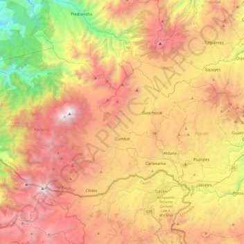
Name: Cumbal topographic map, elevation, terrain.

Location: Cumbal, Exprovincia de Obando, Nariño, RAP Pacífico, Colombia (0.80129 -78.20918 1.07796 -77.75610)

Average elevation: 3,092 m

Minimum elevation: 1,426 m

Maximum elevation: 4,734 m

Gear up for your next adventure:

🧳Compression Sacks - Maximize space in your backpack by shrinking gear
📷Outdoor Action Camera - Capture high-elevation views and rugged adventures
🥾Mountain Hiking Boots - High-traction boots for rocky terrain
🥾Light Hiking Boots - Lightweight and comfortable boots for day hikes
🥾Hiking Gaiters - Protect legs and shoes from mud, snow, and debris

As an Amazon Associate, this site earns from qualifying purchases at no extra cost to you.