Geolocate

Maseta topographic map

Click on the map to display elevation.

About this map

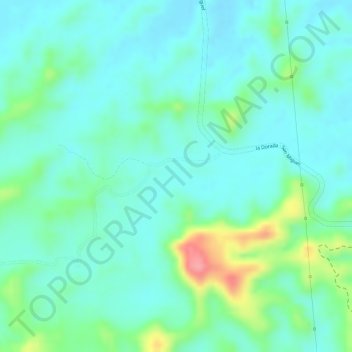
Name: Maseta topographic map, elevation, terrain.

Location: Maseta, La Dorada, Magdalena Caldense, Caldas, Colombia (5.60310 -74.73269 5.62310 -74.71269)

Average elevation: 209 m

Minimum elevation: 182 m

Maximum elevation: 288 m

Gear up for your next adventure:

Family Camping Tent - Spacious tent suitable for family camping trips
🛰️Satellite Messenger - Emergency communication for areas with no cell service
💡Portable Camping Lamp - Rechargeable lamp for campsite lighting
🧊Insulated Water Bottle - Keeps drinks cold in summer and prevents freezing in winter
🧦Hiking Socks - Moisture-wicking and comfortable socks for long hikes

As an Amazon Associate, this site earns from qualifying purchases at no extra cost to you.