Nevada topographic maps
Click on a map to view its topography, its elevation and its terrain.
Ruby Mountains
United States > Nevada > Elko County
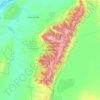
The Ruby Mountains (Shoshoni: 'Duka Doya', meaning “Snowcapped”) are a mountain range, primarily located within Elko County with a small extension into White Pine County, in Nevada, United States. Most of the range is included within the Humboldt-Toiyabe National Forest. The range reaches a maximum…
Average elevation: 1,962 m
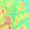
Truckee River
Beavers were re-introduced to the Truckee River watershed and Tahoe Basin by the California Department of Fish and Game (CDFG) and the U. S. Forest Service between 1934 and 1949 in order to prevent stream degradation and to promote wetland restoration. That beaver were once native to the area is supported by…
Average elevation: 1,728 m

Craig Ranch Regional Park
United States > Nevada > Clark County > North Las Vegas
Average elevation: 626 m


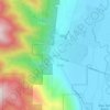

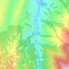
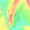
Jackpot
United States > Nevada > Elko County
In addition to its casino industry, Jackpot has its own schools, golf course, and post office. Its elevation is approximately 5,200 feet (1,580 m) above sea level.
Average elevation: 1,635 m
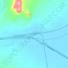


Ruth
United States > Nevada > White Pine County
Ruth experiences a semi-arid climate (Bsk) with hot summers and cold winters, typical of most small towns in the Great Basin. Due to Ruth's substantial elevation and aridity, the diurnal temperature variation is large. Nights are cool, even in the summer, and frosts can occur any time of the year, although…
Average elevation: 2,116 m
Gerlach
United States > Nevada > Washoe County
According to the United States Census Bureau, the Gerlach CDP has a total area of 3.1 square miles (8.0 km2), all land. Its elevation is 3,944 ft (1,202 m). Gerlach is approximately 100 miles (160 km) north of Reno, Nevada.
Average elevation: 1,208 m




Highland Range Crucial Bighorn Habitat Area
United States > Nevada > Clark County
Average elevation: 917 m
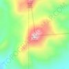
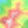
Boundary Peak
United States > Nevada > Esmeralda County
Boundary Peak is a mountain in Esmeralda County, Nevada, United States. With a peak elevation of 13,147 feet (4,007 m), it is the highest natural point in the state of Nevada.
Average elevation: 3,515 m
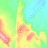
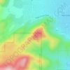


Amargosa Valley
United States > Nevada > Nye County
Amargosa Valley is located at 36.58001 North, 116.44487 West at an elevation of 2,640 feet (805 m) above sea level. The landscape is typical of lower to moderate elevations in the Mojave Desert, with flat expanses of sandy soil punctuated by rocky mounds and hills. Predominant indigenous vegetation is White…
Average elevation: 740 m






Mason Valley Swimming Pool Park
United States > Nevada > Lyon County > Yerington
Average elevation: 1,336 m


Spring Mountain Ranch State Park
United States > Nevada > Clark County
"Because of the higher elevation, the ranch offers a diverse opportunity for plant study. Four plant communities are represented: Desert Scrub, Black brush, Pinon-Juniper, and Riparian. Plants typical of the desert as well as woodland can be seen, and with adequate rainfall the spring brings a burst of…
Average elevation: 1,188 m


Ruby Mountains
United States > Nevada > Elko County
The Ruby Mountains (Shoshoni: 'Duka Doya', meaning “Snowcapped”) are a mountain range, primarily located within Elko County with a small extension into White Pine County, in Nevada, United States. Most of the range is included within the Humboldt-Toiyabe National Forest. The range reaches a maximum…
Average elevation: 2,867 m
Gardnerville Ranchos
United States > Nevada > Douglas County > Gardnerville Ranchos
Average elevation: 1,471 m
Blue Diamond
United States > Nevada > Clark County > Blue Diamond
Blue Diamond is the site of Cottonwood Spring (formerly known as Ojo de Cayetana, or Pearl Spring), a watering place and camp site on the Old Spanish Trail and the later Mormon Road between Mountain Springs and Las Vegas Springs. The springs are located on a mountainside south of the town at 36°02′44″N…
Average elevation: 1,102 m
Fallon
United States > Nevada > Churchill County
Fallon experiences a cold desert climate, with hot summers and cold winters. Due to Fallon's elevation and aridity, the diurnal temperature variation is quite substantial, especially in the summer months. Fallon's climate is quite dry, due to its location in the rain shadow of the Sierra Nevada. Summer days…
Average elevation: 1,210 m
North Jackson Mountains Wilderness
United States > Nevada > Humboldt County
Average elevation: 1,747 m

Spooner Lake & Backcountry State Park
United States > Nevada > Washoe County > Incline Village-Crystal Bay
Average elevation: 2,108 m
Snake Range
United States > Nevada > White Pine County
The Snake Range is a mountain range in White Pine County, Nevada, United States. The south-central portion of the range is included within Great Basin National Park, with most of the remainder included within the Humboldt-Toiyabe National Forest. The range reaches a maximum elevation of 13,065 feet (3,982 m)…
Average elevation: 1,996 m


Las Vegas Valley
United States > Nevada > Clark County
The Las Vegas Valley lies in a relatively high-altitude portion of the Mojave Desert, with a subtropical hot-desert climate. The Valley generally averages less than 5 in (130 mm) of rain annually. Daily daytime summer temperatures in July and August typically range from 100 °F (38 °C) to 110 °F (43 °C),…
Average elevation: 840 m

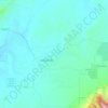
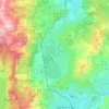
Washoe Valley
United States > Nevada > Washoe County
Washoe Valley is a very fire prone area. This is mostly due to the fire fueling vegetation and the topography, with several slopes in the area. Additionally, there is limited water residents can use to protect structures in the case of a fire.
Average elevation: 1,886 m

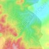
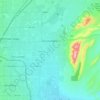

Rancho San Rafael Regional Park
United States > Nevada > Washoe County > Reno
Average elevation: 1,443 m


Fremont East Entertainment District
United States > Nevada > Clark County > Las Vegas
Average elevation: 606 m


Pahrump
United States > Nevada > Nye County
Summers in Pahrump are generally very hot and dry, with occasional pushes of monsoonal moisture beginning in early July. Being at a similar elevation to Las Vegas, daytime highs in summer average within a few degrees lower than that of Las Vegas. Record highs are similar between the two cities as well. A…
Average elevation: 1,060 m


Devils Hole
United States > Nevada > Nye County
Devils Hole is a geothermal pool within a limestone cavern in the Amargosa Desert in the Amargosa Valley of Nevada, east over the Amargosa Range and Funeral Mountains from Death Valley. It is at an elevation of 730 m (2,400 ft) above sea level and the water is a constant temperature of 33 °C (91 °F). The…
Average elevation: 756 m
Great Basin National Park
United States > Nevada > White Pine County
The park derives its name from the Great Basin, the dry and mountainous region between the Sierra Nevada and the Wasatch Mountains. Topographically, this area is known as the Basin and Range Province. The park is located about 290 miles (470 km) north of Las Vegas and protects 77,180 acres (31,230 ha).
Average elevation: 2,352 m


Summerlin Centre Community Park
United States > Nevada > Clark County > Summerlin South > Summerlin Centre
Average elevation: 902 m