Geolocate

Esmeralda County topographic maps

Click on a map to view its topography, its elevation and its terrain.
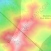
Boundary Peak

United States > Nevada > Esmeralda County

Boundary Peak is a mountain in Esmeralda County, Nevada, United States. With a peak elevation of 13,147 feet (4,007 m), it is the highest natural point in the state of Nevada.

Average elevation: 3,515 m

Ruby Hills

United States > Nevada > Esmeralda County

Average elevation: 1,741 m

Silver Peak

United States > Nevada > Esmeralda County

Average elevation: 1,350 m

Adams Peak

United States > Nevada > Esmeralda County

Average elevation: 1,644 m

Gear up for your next adventure:

🧢Hiking Hat - Sun-protective and breathable hats for long treks
💧Hydration Pack - Hands-free hydration system for long hikes
🧭GPS Outdoor Watch - Smart watch for navigation and fitness tracking in nature
🧣Merino Neck Gaiter - Protects against wind, sun, and cold at high altitudes
🛰️Satellite Messenger - Emergency communication for areas with no cell service

As an Amazon Associate, this site earns from qualifying purchases at no extra cost to you.