Geolocate

Sunrise Manor topographic map

Click on the map to display elevation.

About this map
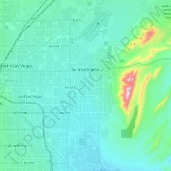
Name: Sunrise Manor topographic map, elevation, terrain.

Location: Sunrise Manor, Clark County, Nevada, United States (36.10759 -115.11614 36.26191 -114.98481)

Average elevation: 599 m

Minimum elevation: 451 m

Maximum elevation: 1,222 m

Gear up for your next adventure:

🚑Survival Whistle - Signal for help across long distances in mountains
🥾Approach Shoes - Shoes designed for climbing approaches and rugged trails
🚲Heavy Duty Bike Lock - Secure your bike at the trailhead or during stops
⛺Family Camping Tent - Spacious tent suitable for family camping trips
🛶Canoe Life Vest - Safety vest for water sports

As an Amazon Associate, this site earns from qualifying purchases at no extra cost to you.