Geolocate

Netherlands topographic maps

Click on a map to view its topography, its elevation and its terrain.
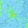
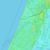
Amsterdam

Netherlands > North Holland > Amsterdam

Average elevation: -1 m

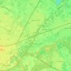
Zaandam

Netherlands > North Holland

Average elevation: 0 m

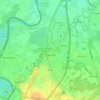
Waalre

Netherlands > North Brabant

Average elevation: 22 m

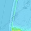
Utrecht

Netherlands > Utrecht > Utrecht

Average elevation: 3 m

Vlissingen

Netherlands > Zeeland > Vlissingen

Topographic map of Vlissingen (city), Sept. 2014

Average elevation: 0 m
Heerenveen

Netherlands > Frisia

Average elevation: 0 m

Hoorn

Netherlands > North Holland

Average elevation: -1 m

Oosterwijzend

Netherlands > North Holland > Hoogkarspel

Average elevation: -2 m

Oud-Zevenaar

Netherlands > Gelderland > Zevenaar

Average elevation: 12 m

Zandvoort

Netherlands > North Holland

Average elevation: 4 m

Berkel-Enschot

Netherlands > North Brabant

Average elevation: 13 m

Born

Netherlands > Limburg

Average elevation: 34 m

de Putten

Netherlands > North Holland > Schoorl

Average elevation: 0 m

Cadzand

Netherlands > Zeeland

Average elevation: 1 m

Beek

Netherlands > Limburg

The municipality of Beek makes part of the region of South Limburg and lies between the city of Geleen in the north and Maastricht in the south, and lies furthermore southeast of interchange Kerensheide and the chemical industries of Chemelot. It has a slightly hilly landscape with altitudes differing between…

Average elevation: 102 m
Aruba

Netherlands

Average elevation: 11 m

Wittewierum

Netherlands > Groningen > Ten Post

Average elevation: -1 m

Meuse

Netherlands > Limburg > Baarlo

Average elevation: 22 m

Olterterp

Netherlands > Frisia

Average elevation: 3 m

Waalwijk

Netherlands > North Brabant

Average elevation: 3 m

Best

Netherlands > North Brabant

Average elevation: 15 m

Meteren

Netherlands > Gelderland

Average elevation: 4 m

Den Burg

Netherlands > North Holland

Average elevation: 1 m

Katwijk

Netherlands > South Holland

Average elevation: 3 m

Beek

Netherlands > Gelderland

Average elevation: 38 m

America

Netherlands > Limburg

Average elevation: 31 m

Saba

Netherlands

There is an 8.6 hectares (21 acres) cloud forest located at and above 825 metres (2,707 ft) on top of the mountain referred to as the "Elfin Forest Reserve" because of its high altitude mist and mossy appearance. The most dominant tree in the cloud forest is the Mountain Mahogany (Freziera undulate), although…

Average elevation: 2 m
Zuidbarge

Netherlands > Drenthe > Emmen

Average elevation: 20 m

Hout

Netherlands > North Brabant > Geldrop

Average elevation: 22 m

Flevoland

Netherlands

Average elevation: 1 m

Zeewolde

Netherlands > Flevoland

Average elevation: -2 m

Purmerend

Netherlands > North Holland > Purmerend

Average elevation: -2 m

Groningen

Netherlands > Groningen > Groningen

Average elevation: 2 m

Ede

Netherlands > Gelderland

Average elevation: 30 m

About this place

 •  •  •  •  •  •  •  •  •  •

Gear up for your next adventure:

🧭GPS Handheld Device - Reliable GPS navigation for outdoor adventures
🧦Hiking Socks - Moisture-wicking and comfortable socks for long hikes
💡LED Headlamp - Hands-free illumination for night hiking and camping
🧥Thermal Layer - Insulating layer for cold outdoor conditions
🔦LED Flashlight - Powerful and long-lasting flashlight for camping and emergencies

As an Amazon Associate, this site earns from qualifying purchases at no extra cost to you.