Geolocate

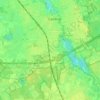
Waalwijk topographic map

Click on the map to display elevation.

About this map

Name: Waalwijk topographic map, elevation, terrain.

Location: Waalwijk, North Brabant, Netherlands (51.66806 5.02765 51.72234 5.11151)

Average elevation: 3 m

Minimum elevation: -4 m

Maximum elevation: 16 m

Other topographic maps

Click on a map to view its topography, its elevation and its terrain.
Hout

Netherlands > North Brabant > Geldrop

Average elevation: 22 m

Gear up for your next adventure:

🦯Trekking Poles - Reduced impact on joints for steep topographic climbs
🌡️Emergency Mylar Blankets - Compact thermal protection for unexpected nights outdoors
🥾Lightweight Hiking Boots - Boots for comfort and mobility on long hikes
🥾Waterproof Hiking Boots - Boots keeping your feet dry in wet conditions
🥾Trail Hiking Boots - Supportive boots for rough trails

As an Amazon Associate, this site earns from qualifying purchases at no extra cost to you.