Geolocate

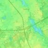
Best topographic map

Click on the map to display elevation.

About this map

Name: Best topographic map, elevation, terrain.

Location: Best, North Brabant, Netherlands (51.48381 5.34936 51.54835 5.44751)

Average elevation: 15 m

Minimum elevation: 6 m

Maximum elevation: 23 m

Other topographic maps

Click on a map to view its topography, its elevation and its terrain.
Hout

Netherlands > North Brabant > Geldrop

Average elevation: 22 m

Gear up for your next adventure:

🧴Outdoor Sunscreen - High SPF protection for high-altitude UV exposure
🧢Outdoor Cap - Protective cap for sun and rain during hikes
🥽Outdoor Goggles - Protective eyewear for outdoor activities
🥾Trail Hiking Boots - Supportive boots for rough trails
🪑Ultralight Camping Stool - Compact seating for rest stops during long hikes

As an Amazon Associate, this site earns from qualifying purchases at no extra cost to you.