
Meteren topographic map
Click on the map to display elevation.
About this map
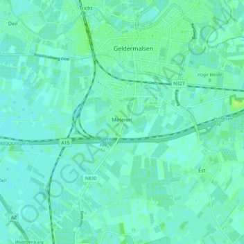
Name: Meteren topographic map, elevation, terrain.
Location: Meteren, West Betuwe, Gelderland, Netherlands (51.85169 5.23875 51.87467 5.32836)
Average elevation: 4 m
Minimum elevation: 0 m
Maximum elevation: 11 m
Other topographic maps
Click on a map to view its topography, its elevation and its terrain.