Geolocate

Meditation Lake topographic map

Interactive map

Click on the map to display elevation.

About this map

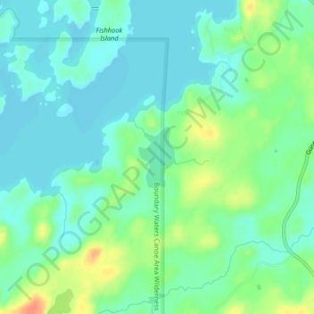
Name: Meditation Lake topographic map, elevation, terrain.

Location: Meditation Lake, Cook County, Minnesota, United States (48.12968 -90.88273 48.13493 -90.87797)

Average elevation: 453 m

Minimum elevation: 439 m

Maximum elevation: 485 m

Other topographic maps

Click on a map to view its topography, its elevation and its terrain.

Edina

United States > Minnesota > Hennepin County

Average elevation: 271 m

Lakeville

United States > Minnesota > Dakota County

Average elevation: 305 m

Cook County

United States > Minnesota

Average elevation: 384 m

Rock County

United States > Minnesota

Rock County is located at the southwestern corner of Minnesota. Its western border shares a boundary with the eastern border of South Dakota, while its southern border is adjacent to the northern border of Iowa. The county is characterized by the flow of the Rock River, which runs southward through its east…

Average elevation: 469 m

Humboldt

United States > Minnesota > Kittson County

Average elevation: 243 m

Heron Lake

United States > Minnesota > Jackson County

Average elevation: 432 m

Melrude

United States > Minnesota > Saint Louis County

Average elevation: 413 m

Ogema

United States > Minnesota > Becker County

Average elevation: 389 m

Regina

United States > Minnesota > Hennepin County > Minneapolis

Average elevation: 263 m

Moorhead

United States > Minnesota > Clay County

Average elevation: 277 m

Robbinsdale

United States > Minnesota > Hennepin County

Average elevation: 270 m

Maple Grove

United States > Minnesota > Hennepin County

Average elevation: 278 m

Elk River

United States > Minnesota > Sherburne County

Average elevation: 283 m

Pine County

United States > Minnesota

Average elevation: 326 m

Wilmont

United States > Minnesota > Nobles County

According to the United States Census Bureau, the city has a total area of 1.14 square miles (2.95 km2), all land. By elevation, Wilmont is the highest incorporated community in Nobles County.

Average elevation: 527 m

Goodhue County

United States > Minnesota

Average elevation: 310 m

Madison

United States > Minnesota > Lac qui Parle County

Average elevation: 332 m

Fridley

United States > Minnesota > Anoka County

Average elevation: 270 m

Saint Paul

United States > Minnesota > Ramsey County

The year 1858 saw more than 1,000 steamboats service Saint Paul, making it a gateway for settlers to the Minnesota frontier or Dakota Territory. Geography was a primary reason the city became a transportation hub. The location was the last good point to land riverboats coming upriver due to the river valley's…

Average elevation: 268 m

Frontenac

United States > Minnesota > Goodhue County

Average elevation: 243 m

Border

United States > Minnesota > Koochiching County

Average elevation: 333 m

Eagle Mountain

United States > Minnesota > Cook County

Eagle Mountain is only about 15 miles (24 km) from Minnesota's lowest elevation, Lake Superior, at 600 feet (183 m). It is part of the Canadian Shield. There is also another much shorter peak also named Eagle Mountain in northern Minnesota. The shorter peak is part of the Lutsen Mountains ski resort.

Average elevation: 596 m

Cyrus

United States > Minnesota > Pope County

Average elevation: 348 m

Plymouth

United States > Minnesota > Hennepin County

Average elevation: 294 m

Sandstone

United States > Minnesota > Pine County

Average elevation: 332 m

St. James

United States > Minnesota > Watonwan County

Average elevation: 328 m

Sea Gull Lake

United States > Minnesota > Cook County

Average elevation: 460 m

Alice Lake

United States > Minnesota > Lake County

Average elevation: 474 m

Courtland

United States > Minnesota > Nicollet County

Average elevation: 281 m

Howard Lake

United States > Minnesota > Wright County

Average elevation: 312 m

Link Lake

United States > Minnesota > Lake County

Average elevation: 452 m

Grant County

United States > Minnesota

Average elevation: 347 m

McGrath

United States > Minnesota > Aitkin County

Average elevation: 379 m

Bloomington

United States > Minnesota > Hennepin County

Average elevation: 255 m

Babbitt

United States > Minnesota > Saint Louis County

Average elevation: 484 m

Ash Lake

United States > Minnesota > Saint Louis County

Average elevation: 413 m

Lakefield

United States > Minnesota > Jackson County

Average elevation: 450 m

East Gull Lake

United States > Minnesota > Cass County

Average elevation: 370 m

Finlayson

United States > Minnesota > Pine County

Average elevation: 339 m

Lake Elmo

United States > Minnesota > Washington County

Average elevation: 287 m

Lanesboro

United States > Minnesota > Fillmore County

Average elevation: 299 m

Swift County

United States > Minnesota

Swift County is primarily agricultural, but also hosts agriculture equipment manufacturers and an ethanol plant. It has 24 lakes and nine rivers and streams. Lake Oliver is one of the county's biggest, at 416 acres (1.7 km2). Caltopo shows the true highpoint to be 1300 ft in elevation about 1/3 of a mile…

Average elevation: 332 m

Fosston

United States > Minnesota > Polk County

Average elevation: 393 m

Grand Rapids

United States > Minnesota > Itasca County

Average elevation: 398 m

Shorewood

United States > Minnesota > Hennepin County

Average elevation: 289 m

Faribault County

United States > Minnesota

Average elevation: 340 m

Byron

United States > Minnesota > Olmsted County

Average elevation: 365 m

Cream Lake

United States > Minnesota > Cook County

Average elevation: 574 m

George Lake

United States > Minnesota > Cook County

Average elevation: 551 m

Skyline

United States > Minnesota > Blue Earth County

According to the U.S. Census Bureau, the city has a total area of 0.17 square miles (0.44 km2), all land. Its elevation is 980 feet (300 m) above sea-level.

Average elevation: 265 m

Zumbrota

United States > Minnesota > Goodhue County

Average elevation: 312 m

Becker County

United States > Minnesota

Becker County has diverse topography. It is home to several hundred lakes, many acres of fertile farm land, and forested areas. Much of the land consists of hills and deciduous trees.

Average elevation: 439 m

Lucan

United States > Minnesota > Redwood County

Average elevation: 331 m

Kennedy

United States > Minnesota > Kittson County

Average elevation: 251 m

Roseau County

United States > Minnesota > Roseau County

Average elevation: 341 m

Pine River

United States > Minnesota > Cass County

Average elevation: 395 m

Avon

United States > Minnesota > Stearns County

Average elevation: 351 m

Rauch

United States > Minnesota > Koochiching County

Average elevation: 388 m

Minneapolis

United States > Minnesota > Hennepin County > Minneapolis

A 1959 report by the U.S. Soil Conservation Service listed Minneapolis's elevation as 830 feet (250 m). The city's lowest elevation of 687 feet (209 m) above sea level is near where Minnehaha Creek meets the Mississippi River. Sources disagree on the exact location and elevation of the city's highest point,…

Average elevation: 271 m

New Germany

United States > Minnesota > Carver County

Average elevation: 299 m

Otter Tail County

United States > Minnesota

Average elevation: 413 m

St. Anthony

United States > Minnesota > Hennepin County

Average elevation: 286 m

Andover

United States > Minnesota > Anoka County

Average elevation: 273 m

Nobles County

United States > Minnesota

Nobles County sits atop the Buffalo Ridge, a large expanse of rolling hills in southwestern Minnesota reaching a height of 1,995' (608m) ASL. The Buffalo Ridge marks the most southerly extent of the last glaciation, and extends 60 miles (96 km) through Lincoln, Lyon, Pipestone, Murray, Rock, and Nobles…

Average elevation: 487 m

Calumet

United States > Minnesota > Itasca County

Average elevation: 421 m

Polk County

United States > Minnesota

Average elevation: 312 m

Gaylord

United States > Minnesota > Sibley County

Average elevation: 302 m

Wilton

United States > Minnesota > Beltrami County

Average elevation: 425 m

Lac qui Parle County

United States > Minnesota

Average elevation: 331 m

Eagan

United States > Minnesota > Dakota County

Average elevation: 267 m

Redwood County

United States > Minnesota

Average elevation: 326 m

Roseau River

United States > Minnesota

Average elevation: 310 m

Pipestone County

United States > Minnesota

Average elevation: 523 m

Pine Island

United States > Minnesota > Goodhue County

Average elevation: 327 m

Murray County

United States > Minnesota

The county terrain consists of low rolling hills, dotted with lakes and ponds, with all available area devoted to agriculture. The terrain slopes to the south and east. However, its highest elevation occurs on Buffalo Ridge, a promontory extending about two miles along the crest of the Coteau des Prairies in…

Average elevation: 485 m

Scott County

United States > Minnesota

Average elevation: 289 m

Lincoln County

United States > Minnesota

Average elevation: 510 m

Jackson County

United States > Minnesota

Average elevation: 435 m

Carver County

United States > Minnesota

Average elevation: 289 m

Duluth

United States > Minnesota > Saint Louis County

Duluth's topography is dominated by a steep hillside that climbs from Lake Superior to high inland elevations. Duluth has been called "the San Francisco of the Midwest," alluding to San Francisco's similar water-to-hilltop topography. This similarity was most evident before World War II, when Duluth had a…

Average elevation: 286 m

Saint Louis County

United States > Minnesota

Average elevation: 398 m

Beltrami County

United States > Minnesota

Average elevation: 386 m

White Earth

United States > Minnesota > Becker County

Average elevation: 459 m

Mankato

United States > Minnesota > Blue Earth County > Mankato

Average elevation: 285 m

Owatonna

United States > Minnesota > Steele County

Average elevation: 361 m

Tenney

United States > Minnesota > Wilkin County

Average elevation: 302 m

Tofte

United States > Minnesota > Cook County > Tofte

Average elevation: 223 m

Burnsville

United States > Minnesota > Dakota County > Burnsville

Average elevation: 271 m