
Rauch topographic map
Click on the map to display elevation.
About this map
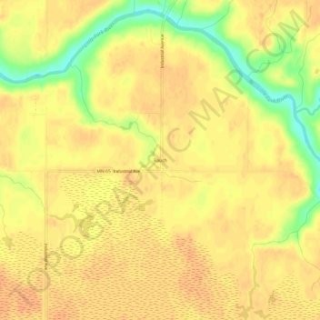
Name: Rauch topographic map, elevation, terrain.
Location: Rauch, Koochiching County, Minnesota, United States (47.93882 -93.16573 47.97882 -93.12573)
Average elevation: 388 m
Minimum elevation: 362 m
Maximum elevation: 397 m
Other topographic maps
Click on a map to view its topography, its elevation and its terrain.