Geolocate

Four Corners topographic map

Click on the map to display elevation.

About this map

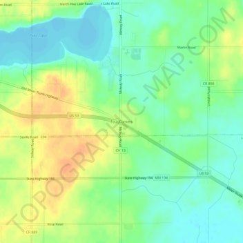
Name: Four Corners topographic map, elevation, terrain.

Location: Four Corners, Saint Louis County, Minnesota, United States (46.83327 -92.30019 46.87327 -92.26019)

Average elevation: 438 m

Minimum elevation: 423 m

Maximum elevation: 458 m

Other topographic maps

Click on a map to view its topography, its elevation and its terrain.

Babbitt

United States > Minnesota > Saint Louis County

Average elevation: 484 m

Mug Lake

United States > Minnesota > Saint Louis County

Average elevation: 375 m

Gear up for your next adventure:

🥾Trekking Poles - Adjustable trekking poles to reduce knee stress and improve stability
🩹Moleskin Blister Pads - Direct protection for painful foot pressure points
💡Solar Camping Lamp - Eco-friendly lighting for campsites
🏕️Camping Hammock - Integrated protection for sleeping between trees
🥾Trail Hiking Shoes - Durable shoes designed for rugged trails

As an Amazon Associate, this site earns from qualifying purchases at no extra cost to you.