
Câmpeni topographic map
Click on the map to display elevation.
About this map
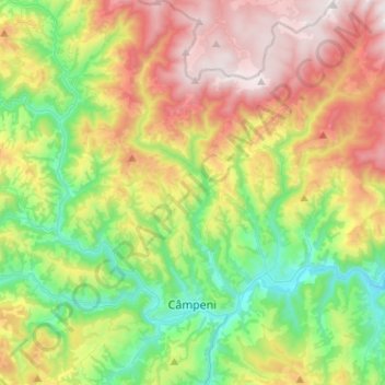
Name: Câmpeni topographic map, elevation, terrain.
Location: Câmpeni, Alba, Romania (46.32864 22.98787 46.50203 23.12283)
Average elevation: 967 m
Minimum elevation: 512 m
Maximum elevation: 1,650 m
Other topographic maps
Click on a map to view its topography, its elevation and its terrain.