Geolocate

Coasta Vâscului topographic map

Click on the map to display elevation.

About this map

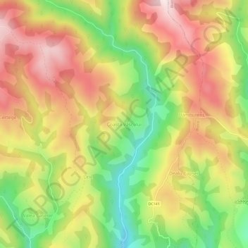
Name: Coasta Vâscului topographic map, elevation, terrain.

Location: Coasta Vâscului, Câmpeni, Alba, 515505, Romania (46.39303 23.03379 46.43303 23.07379)

Average elevation: 907 m

Minimum elevation: 619 m

Maximum elevation: 1,172 m

Gear up for your next adventure:

🧼Travel Hand Sanitizer - Keep hands clean when water is scarce
🛶Kayak Accessories - Essential gear for safe and fun kayaking adventures
🥤Collapsible Travel Cup - Saves space and weight in your mess kit
💧Collapsible Water Bottle - Space-saving water bottle for outdoor activities
💧Reusable Water Bottle - Durable water bottles for hydration on trails

As an Amazon Associate, this site earns from qualifying purchases at no extra cost to you.