Geolocate

Horea topographic map

Click on the map to display elevation.

About this map

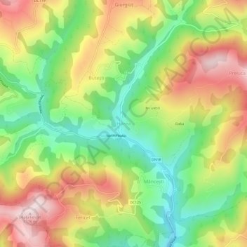
Name: Horea topographic map, elevation, terrain.

Location: Horea, Alba, 517340, Romania (46.48207 22.93005 46.52207 22.97005)

Average elevation: 909 m

Minimum elevation: 682 m

Maximum elevation: 1,174 m

Gear up for your next adventure:

💧Filtered Water Bottle - Safe drinking water on the go
🧥Packable Rain Jacket - Breathable waterproof layer for unpredictable weather
🥾Trekking Poles - Adjustable trekking poles to reduce knee stress and improve stability
🏕️Camping Hammock - Integrated protection for sleeping between trees
🌡️Emergency Mylar Blankets - Compact thermal protection for unexpected nights outdoors

As an Amazon Associate, this site earns from qualifying purchases at no extra cost to you.