Geolocate

Boțani topographic map

Click on the map to display elevation.

About this map

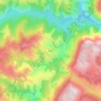
Name: Boțani topographic map, elevation, terrain.

Location: Boțani, Dealu Geoagiului, Întregalde, Alba, 517591, Romania (46.26582 23.41654 46.30582 23.45654)

Average elevation: 866 m

Minimum elevation: 559 m

Maximum elevation: 1,175 m

Gear up for your next adventure:

💧Collapsible Water Bottle - Space-saving water bottle for outdoor activities
🔦LED Flashlight - Powerful and long-lasting flashlight for camping and emergencies
🧴Outdoor Sunscreen - High SPF protection for high-altitude UV exposure
🏃Hydration Running Vest - Carry water and maps close to your body for speed
🧥Waterproof Hiking Jacket - Protect yourself from rain and wind while hiking

As an Amazon Associate, this site earns from qualifying purchases at no extra cost to you.