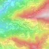
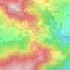
Baglung topographic map
Click on the map to display elevation.
Baglung
Baglung is surrounded by Parbat, Myagdi, Rukum, Rolpa, Pyuthan and Gulmi districts. It has 59 Village Development Committees and one Municipality. Baglung has the moniker "District of suspension bridges" as there are numerous suspension bridges. It is a hilly district, and most of the population settled on the sides of the rivers. Fertile plains situated on either side of the rivers are used for farming. The headquarters of Baglung District is Baglung Municipality which is located on a plateau overlooking the holy Kali Gandaki. Like Nepal, Baglung is also diverse in religion, culture, ethnicity, altitude, temperature etc. Hinduism and Buddhism are the major religions.
About this map

Name: Baglung topographic map, elevation, terrain.
Location: Baglung, Gandaki Province, Nepal (28.07739 82.87511 28.63544 83.67431)
Average elevation: 2,325 m
Minimum elevation: 527 m
Maximum elevation: 8,142 m
Other topographic maps
Click on a map to view its topography, its elevation and its terrain.




Wāling
Nepal > Gandaki Province > Syangja
Waling Municipality experiences a subtropical highland climate, characteristic of the hilly regions of Nepal. The climate in Waling is influenced by its varying elevation, ranging from 731 meters to 1,600 meters above sea level.
Average elevation: 969 m



Sarangkot
Nepal > Gandaki Province > Kaski > Pokhara
The Ward is located on Sarangkot, a hill on the western side of Pokhara with an altitude of 1600m. Sarangkot is known for its panoramic Himalayan views of Dhaulagiri, Annapurna and Manaslu. It also provides an expansive view of the city of Pokhara, from the extreme north to the south including Phewa Lake.…
Average elevation: 1,139 m

Manaslu
Nepal > Gandaki Province > Gorkha
The Manaslu region offers a variety of trekking options. The popular Manaslu trekking route of 177 kilometres (110 mi) skirts the Manaslu massif over the pass down to Annapurna. The Nepalese Government only permitted trekking on this circuit in 1991. The trekking trail follows an ancient salt-trading route…
Average elevation: 7,069 m


Annapurna I
Nepal > Gandaki Province > Myagdi
The mountain is named after Annapurna, the Hindu goddess of food and nourishment, who is said to reside there. The name Annapurna is derived from the Sanskrit-language words purna ("filled") and anna ("food"), and can be translated as "everlasting food". Many streams descending from the slopes of the Annapurna…
Average elevation: 7,126 m
Manaslu
Nepal > Gandaki Province > Gorkha
The Manaslu region offers a variety of trekking options. The popular Manaslu trekking route of 177 kilometres (110 mi) skirts the Manaslu massif over the pass down to Annapurna. The Nepalese Government only permitted trekking on this circuit in 1991. The trekking trail follows an ancient salt-trading route…
Average elevation: 7,069 m
Manang
Nepal > Gandaki Province > Manang
Manang (Nepali: मनाङ) is a town in the Manang District of Nepal. It is located at 28°40'0N 84°1'0E with an elevation of 3,519 metres (11,545 ft). According to the preliminary results of the 2011 Nepal census, the district has a population of 6,527 people living in 1,495 individual households. Its…
Average elevation: 3,855 m
Jomsom
Nepal > Gandaki Province > Mustang
Jomsom (Nepali: जोमसोम), (Ward No. 4 of Gharpajhong Rural Municipality) also known as Dzongsam (New Fort), is the centre of Gharapjhong rural municipality in Mustang district and a former independent village development committee situated at an altitude of about 2,700 metres (8,900 ft) in Gandaki…
Average elevation: 3,061 m
Annapurna I
Nepal > Gandaki Province > Myagdi
The mountain is named after Annapurna, the Hindu goddess of food and nourishment, who is said to reside there. The name Annapurna is derived from the Sanskrit-language words purna ("filled") and anna ("food"), and can be translated as "everlasting food". Many streams descending from the slopes of the Annapurna…
Average elevation: 7,126 m
Manang
Nepal > Gandaki Province > Manang
Manang (Nepali: मनाङ) is a town in the Manang District of Nepal. It is located at 28°40'0N 84°1'0E with an elevation of 3,519 metres (11,545 ft). According to the preliminary results of the 2011 Nepal census, the district has a population of 6,527 people living in 1,495 individual households. Its…
Average elevation: 3,855 m

Annapurna I
Nepal > Gandaki Province > Myagdi
The mountain is named after Annapurna, the Hindu goddess of food and nourishment, who is said to reside there. The name Annapurna is derived from the Sanskrit-language words purna ("filled") and anna ("food"), and can be translated as "everlasting food". Many streams descending from the slopes of the Annapurna…
Average elevation: 7,126 m

Bhimad
Nepal > Gandaki Province > Tanahun
Rangrung is famous for its altitude, accessing panoramic views of the broad Himalayan range. Hill Tower with telescope facilities will be constructed in the near future. This is popular for the resorts and overnight stayers. It has enormous potential for paragliding, this area is also famous for biodiversity.…
Average elevation: 544 m


Hadeban Upabhokta Samiti , Lamachaur -19
Nepal > Gandaki Province > Kaski > Pokhara
Average elevation: 1,042 m



Ngadi Chuli
Nepal > Gandaki Province > Manang
Ngadi Chuli (also known as Peak 29, Dakura, Dakum, or Dunapurna) is a mountain in the Mansiri Himal (or Manaslu Himal), also known as the Gurkha Massif, in Nepal. With an elevation of 7,871 metres (25,823 ft) above sea level, it is the 20th-highest mountain on Earth.
Average elevation: 6,917 m
Machapuchare
Nepal > Gandaki Province > Kaski
Due to its southern position in the range and the particularly low terrain that lies south of the Annapurna Himalayas, which contains three of the 10 highest peaks in the world, Machapuchare commands tremendous vertical relief in a short horizontal distance. This, combined with its steep, pointed profile,…
Average elevation: 5,746 m

Manaslu
Nepal > Gandaki Province > Gorkha
The Manaslu region offers a variety of trekking options. The popular Manaslu trekking route of 177 kilometres (110 mi) skirts the Manaslu massif over the pass down to Annapurna. The Nepalese Government only permitted trekking on this circuit in 1991. The trekking trail follows an ancient salt-trading route…
Average elevation: 7,069 m
Annapurna I
Nepal > Gandaki Province > Myagdi
The mountain is named after Annapurna, the Hindu goddess of food and nourishment, who is said to reside there. The name Annapurna is derived from the Sanskrit-language words purna ("filled") and anna ("food"), and can be translated as "everlasting food". Many streams descending from the slopes of the Annapurna…
Average elevation: 7,126 m

Jomsom
Nepal > Gandaki Province > Mustang
Jomsom (Nepali: जोमसोम), (Ward No. 4 of Gharpajhong Rural Municipality) also known as Dzongsam (New Fort), is the centre of Gharapjhong rural municipality in Mustang district and a former independent village development committee situated at an altitude of about 2,700 metres (8,900 ft) in Gandaki…
Average elevation: 3,061 m


Baglung
Nepal > Gandaki Province > Baglung
Baglung enjoys warm summers and mild winters. Annual average temperatures range from a maximum of 26.6 °C (79.9 °F) and a minimum of 19.1 °C (66.4 °F). Highs above 35 °C (95 °F) and lows below 0 °C (32 °F) are rare. The average annual rainfall recorded is 1,060.9 mm (41.77 in) in 1982. Rainfall is…
Average elevation: 1,358 m


Annapurna I
Nepal > Gandaki Province > Myagdi
The mountain is named after Annapurna, the Hindu goddess of food and nourishment, who is said to reside there. The name Annapurna is derived from the Sanskrit-language words purna ("filled") and anna ("food"), and can be translated as "everlasting food". Many streams descending from the slopes of the Annapurna…
Average elevation: 7,126 m