Geolocate

Sirdibas topographic map

Click on the map to display elevation.

About this map

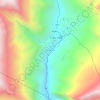
Name: Sirdibas topographic map, elevation, terrain.

Location: Sirdibas, Chum Nubri, Gorkha, Gandaki Province, Nepal (28.36093 84.86910 28.40093 84.90910)

Average elevation: 2,044 m

Minimum elevation: 1,316 m

Maximum elevation: 3,025 m

Other topographic maps

Click on a map to view its topography, its elevation and its terrain.

Gorkha

Nepal > Gandaki Province > Gorkha

Average elevation: 787 m

Chum Nubri

Nepal > Gandaki Province > Gorkha

Average elevation: 4,445 m

Chum Nubri

Nepal > Gandaki Province > Gorkha

Average elevation: 4,445 m

Gear up for your next adventure:

🧼Travel Hand Sanitizer - Keep hands clean when water is scarce
🧥Waterproof Pants - Keep dry during rainy hiking conditions
❄️Traction Ice Cleats - Slip-on spikes for icy trails and winter hiking
🥾Hiking Leggings - Comfortable leggings for outdoor activities
🧤Thermal Hiking Gloves - Grip-enhanced gloves for cold-weather altitude trekking

As an Amazon Associate, this site earns from qualifying purchases at no extra cost to you.