Geolocate

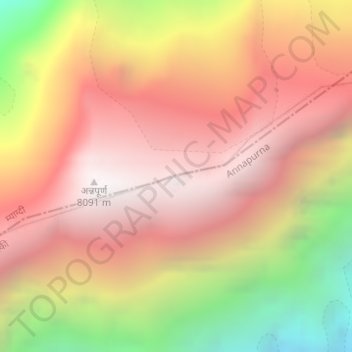
Annapurna I topographic map

Click on the map to display elevation.

Annapurna I

The mountain is named after Annapurna, the Hindu goddess of food and nourishment, who is said to reside there. The name Annapurna is derived from the Sanskrit-language words purna ("filled") and anna ("food"), and can be translated as "everlasting food". Many streams descending from the slopes of the Annapurna Massif provide water for the agricultural fields and pastures located at lower elevations.

Wikipedia (CC-BY-SA 3.0)

About this map

Name: Annapurna I topographic map, elevation, terrain.

Location: Annapurna I, Annapurna-04, Annapurna, Myagdi, Gandaki Province, Nepal (28.59576 83.81987 28.59586 83.81997)

Average elevation: 7,126 m

Minimum elevation: 5,740 m

Maximum elevation: 8,033 m

Other topographic maps

Click on a map to view its topography, its elevation and its terrain.

Malika

Nepal > Gandaki Province > Myagdi

Average elevation: 2,161 m

Mangala

Nepal > Gandaki Province > Myagdi

Average elevation: 1,912 m

Mangala

Nepal > Gandaki Province > Myagdi

Average elevation: 1,912 m

Gear up for your next adventure:

🍽️Titanium Camping Spork - Ultralight and indestructible eating utensil
💧Hydration Pack - Hands-free hydration system for long hikes
🧊Insulated Water Bottle - Keeps drinks cold in summer and prevents freezing in winter
🥾Hiking Gaiters - Protect legs and shoes from mud, snow, and debris
🚑Survival Whistle - Signal for help across long distances in mountains

As an Amazon Associate, this site earns from qualifying purchases at no extra cost to you.