Geolocate

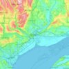
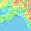
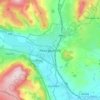
Wrexham topographic map

Click on the map to display elevation.

About this map

Name: Wrexham topographic map, elevation, terrain.

Location: Wrexham, Wales, United Kingdom (52.86659 -3.37552 53.13431 -2.72413)

Average elevation: 150 m

Minimum elevation: 3 m

Maximum elevation: 649 m

Other topographic maps

Click on a map to view its topography, its elevation and its terrain.
Heol-fanog

United Kingdom > Wales > Powys

Average elevation: 296 m

Newport

United Kingdom > Wales > Newport

Average elevation: 89 m

Crickhowell

United Kingdom > Wales > Powys

Average elevation: 253 m

Llangollen

United Kingdom > Wales > Denbighshire

Average elevation: 279 m

Cardiff

United Kingdom > Wales > Cardiff

Average elevation: 55 m

Prestatyn

United Kingdom > Wales > Denbighshire

Average elevation: 48 m

Llandeilo

United Kingdom > Wales > Carmarthenshire

Average elevation: 102 m

Crossgates

United Kingdom > Wales > Powys

Average elevation: 225 m

Holywell

United Kingdom > Wales > Flintshire

Average elevation: 119 m

Cwmtillery

United Kingdom > Wales > Blaenau Gwent

Average elevation: 395 m

Minera

United Kingdom > Wales > Wrexham

Average elevation: 278 m

Penmachno

United Kingdom > Wales > Conwy

Average elevation: 269 m

Ffarmers

United Kingdom > Wales > Carmarthenshire

Average elevation: 224 m

Barmouth

United Kingdom > Wales > Gwynedd

Average elevation: 95 m

Wrexham

United Kingdom > Wales > Wrexham

Average elevation: 139 m

Fairbourne

United Kingdom > Wales > Gwynedd

Average elevation: 78 m

Foel Penolau

United Kingdom > Wales

Average elevation: 423 m

Ysgafell Wen

United Kingdom > Wales

Average elevation: 517 m

Moel Yr Hydd

United Kingdom > Wales

Average elevation: 429 m

Taff

United Kingdom > Wales

Average elevation: 270 m

Fron Goch

United Kingdom > Wales

Average elevation: 196 m

Yr Eifl

United Kingdom > Wales

Average elevation: 257 m

Mynydd Carningli

United Kingdom > Wales

Average elevation: 213 m

Dudwell Mountain

United Kingdom > Wales

Average elevation: 118 m

Penhros Coppice

United Kingdom > Wales

Average elevation: 107 m

Cefn Coch

United Kingdom > Wales

Average elevation: 328 m

Cefn Coch

United Kingdom > Wales

Average elevation: 458 m

Llanarmon yn Iâl

United Kingdom > Wales > Denbighshire

Average elevation: 299 m

Tal-y-bont

United Kingdom > Wales > Ceredigion

Average elevation: 118 m

Gwynedd

United Kingdom > Wales

Average elevation: 332 m

Powys

United Kingdom > Wales

Average elevation: 285 m

Isle of Anglesey

United Kingdom > Wales

Average elevation: 65 m

Bullwell Bay

United Kingdom > Wales

Average elevation: 14 m

Tremadog Bay

United Kingdom > Wales

Average elevation: 0 m

Castell Caernarfon

United Kingdom > Wales > Gwynedd > Caernarfon

Average elevation: 18 m

Newtown

United Kingdom > Wales > Powys

Average elevation: 207 m

Buckley

United Kingdom > Wales > Flintshire

Average elevation: 109 m

Chepstow

United Kingdom > Wales > Monmouthshire

Average elevation: 57 m

Rhyl

United Kingdom > Wales > Denbighshire

Average elevation: 5 m

Pontypool

United Kingdom > Wales > Torfaen

Average elevation: 226 m

Corwen

United Kingdom > Wales > Denbighshire

Average elevation: 274 m

Blaenau Ffestiniog

United Kingdom > Wales > Gwynedd

Average elevation: 379 m

Cwmbrân

United Kingdom > Wales > Torfaen

Average elevation: 138 m

Pen y Fan

United Kingdom > Wales > Powys

Average elevation: 625 m

Trecastle

United Kingdom > Wales > Powys

Average elevation: 279 m

Trefor

United Kingdom > Wales > Gwynedd

Average elevation: 97 m

Porth

United Kingdom > Wales > Rhondda Cynon Taf

Average elevation: 226 m

Bodfari

United Kingdom > Wales > Denbighshire

Average elevation: 88 m

Snowdon

United Kingdom > Wales > Gwynedd

Snowdon (/ˈsnoʊdən/) or Yr Wyddfa (pronounced [ər ˈʊɨ̞̯ðva] (listen)), is the highest mountain in Wales, at an elevation of 1,085 metres (3,560 ft) above sea level, and the highest point in the British Isles outside the Scottish Highlands. It is located in Snowdonia National Park (Parc Cenedlaethol…

Average elevation: 692 m

Pen Llithrig y Wrach

United Kingdom > Wales > Conwy

Average elevation: 501 m

Montgomery

United Kingdom > Wales > Powys

Average elevation: 145 m

Thistleboon

United Kingdom > Wales > Swansea > Mumbles

Average elevation: 16 m

Marchlyn Mawr

United Kingdom > Wales > Gwynedd

Average elevation: 616 m

Briton Ferry

United Kingdom > Wales > Neath Port Talbot

Average elevation: 69 m

Pentraeth

United Kingdom > Wales > Isle of Anglesey

Average elevation: 50 m

River Severn

United Kingdom > Wales > Powys > Welshpool

The River Severn (Welsh: Afon Hafren, pronounced [ˈavɔn ˈhavrɛn]), at 220 miles (354 km) long, is the longest river in Great Britain. It is also the river with the most voluminous flow of water by far in all of England and Wales, with an average flow rate of 107 m3/s (3,800 cu ft/s) at Apperley,…

Average elevation: 92 m

Coed y Parc

United Kingdom > Wales > Conwy

Average elevation: 166 m

Caersws

United Kingdom > Wales > Powys

Average elevation: 145 m

Grwyne Fawr Reservoir

United Kingdom > Wales > Powys

By the end of the 19th-century there were serious water shortages in the western parts of the historic county of Monmouthshire. The area had seen a massive population increase as a result of the steel and coal industries but the supply of water to the area was complicated due to its high altitude. A site for a…

Average elevation: 619 m

Crew Green

United Kingdom > Wales > Powys

Average elevation: 102 m

Knighton

United Kingdom > Wales > Powys

The town became a borough in 1203, with a charter permitting a weekly market and annual fair. The presence of two castles within a comparatively small town suggests that one (the earlier motte and bailey sited atop the town) went out of use before the establishment of the second (the motte with no bailey at…

Average elevation: 295 m

Bryn y Maen

United Kingdom > Wales > Conwy

Average elevation: 178 m

Newgale

United Kingdom > Wales > Pembrokeshire

Average elevation: 40 m

The Coppice

United Kingdom > Wales > Powys > Bwlch

Average elevation: 204 m

Rossett

United Kingdom > Wales > Wrexham

Average elevation: 20 m

Shotton

United Kingdom > Wales > Flintshire

Average elevation: 37 m

Mathern

United Kingdom > Wales > Monmouthshire

Average elevation: 27 m

Bangor

United Kingdom > Wales > Bangor

Average elevation: 149 m

Swansea

United Kingdom > Wales > Swansea

Much of Swansea is hilly with the main area of upland being located in the council ward of Mawr. Areas up to 185 metres (607 ft) in elevation range across the central section: Kilvey Hill, Townhill and Llwynmawr separate the centre of Swansea from its northern suburbs. Cefn Bryn, a ridge of high land, is the…

Average elevation: 73 m

Pontardawe

United Kingdom > Wales > Neath Port Talbot

Average elevation: 161 m

Trawsfynydd

United Kingdom > Wales > Gwynedd

Average elevation: 234 m

Aberystwyth

United Kingdom > Wales > Ceredigion

Aberystwyth experiences an oceanic climate (Köppen climate classification Cfb) similar to almost all of the United Kingdom. This is particularly pronounced due to its west coast location facing the Irish Sea. Air undergoes little land moderation and so temperatures closely reflect the sea temperature when…

Average elevation: 39 m
Abergavenny

United Kingdom > Wales > Monmouthshire

Average elevation: 187 m

Caerleon

United Kingdom > Wales > Gwent > Newport > Caerleon

Average elevation: 37 m

Brecon

United Kingdom > Wales > Powys

Average elevation: 216 m

Builth Wells

United Kingdom > Wales > Powys

Average elevation: 232 m

Llandrindod Wells

United Kingdom > Wales > Powys

Average elevation: 247 m

Llanddewi

United Kingdom > Wales > Swansea

Average elevation: 63 m

Banc Y Garth

United Kingdom > Wales > Carmarthenshire

Average elevation: 342 m

Ton-Mawr

United Kingdom > Wales > Neath Port Talbot

Average elevation: 222 m

Beulah

United Kingdom > Wales > Powys

Average elevation: 239 m

Beulah

United Kingdom > Wales > Ceredigion

Average elevation: 140 m

Colwyn Bay

United Kingdom > Wales > Conwy

Average elevation: 68 m

Llandudno

United Kingdom > Wales > Conwy

Average elevation: 19 m

Grosmont

United Kingdom > Wales > Monmouthshire

Average elevation: 128 m

New Brighton

United Kingdom > Wales > Flintshire

Average elevation: 131 m

Bethlehem

United Kingdom > Wales > Carmarthenshire

Average elevation: 115 m

Murton

United Kingdom > Wales > Swansea

Average elevation: 66 m

Abermorddu

United Kingdom > Wales > Flintshire

Average elevation: 124 m

Abergynolwyn

United Kingdom > Wales > Gwynedd

Average elevation: 187 m

Brynithel

United Kingdom > Wales > Blaenau Gwent

Average elevation: 288 m

Gear up for your next adventure:

🌬️Windproof Camp Stove - Efficient cooking even on exposed mountain peaks
🦯Trekking Poles - Reduced impact on joints for steep topographic climbs
🪜Heavy Duty Carabiners - Multi-use clips for securing gear to your backpack
🧴Sunscreen SPF - Broad-spectrum sunscreen for outdoor activities
🧥Softshell Hiking Jacket - The perfect balance of wind protection and breathability

As an Amazon Associate, this site earns from qualifying purchases at no extra cost to you.