United Kingdom topographic maps
Click on a map to view its topography, its elevation and its terrain.
United Kingdom
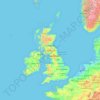
Scotland accounts for just under a third (32 per cent) of the total area of the UK, covering 78,772 square kilometres (30,410 sq mi). This includes nearly eight hundred islands, predominantly west and north of the mainland; notably the Hebrides, Orkney Islands and Shetland Islands. Scotland is the most…
Average elevation: 79 m
Edinburgh
United Kingdom > Scotland > Edinburgh
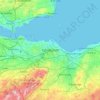
Some have called Edinburgh the Athens of the North for a variety of reasons. The earliest comparison between the two cities showed that they had a similar topography, with the Castle Rock of Edinburgh performing a similar role to the Athenian Acropolis. Both of them had flatter, fertile agricultural land…
Average elevation: 104 m
East Midlands
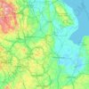
The highest point at 636 m (2,087 ft) is Kinder Scout, in the Peak District of the southern Pennines in northwest Derbyshire near Glossop. Other hilly areas of 95 to 280 m (312 to 919 ft) in altitude, together with lakes and reservoirs, rise in and around the Charnwood Forest north of Peterborough, Leicester,…
Average elevation: 75 m
Kent
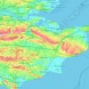
Kent was also the location of the largest number of art schools in the country during the nineteenth century, estimated by the art historian David Haste, to approach two hundred. This is believed to be the result of Kent being a front line county during the Napoleonic Wars. At this time, before the invention…
Average elevation: 37 m
Cambridge
United Kingdom > England > Cambridge
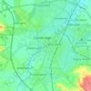
The city, like most of the UK, has a maritime climate highly influenced by the Gulf Stream. Located in the driest region of Britain, Cambridge's rainfall averages around 570 mm (22.44 in) per year, around half the national average, with some years occasionally falling into the semi-arid (under 500 mm (19.69…
Average elevation: 18 m
South East England
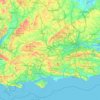
Near Weybridge are the UK headquarters of Sony with SSP Group (situated in Byfleet) and Procter & Gamble (next door to each other on The Heights Business Park near the former Brooklands racing circuit) with Kia Motors UK and Petroleum Geo-Services UK, and Gallaher Group (cigarettes) is to the north, next to…
Average elevation: 69 m
East of England
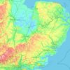
The East of England region has the lowest elevation range in the UK. Twenty percent of the region is below mean sea level, most of this in North Cambridgeshire, Norfolk and on the Essex Coast. Most of the remaining area is of low elevation, with extensive glacial deposits. The Fens, a large area of reclaimed…
Average elevation: 39 m

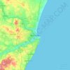
Aberdeen
United Kingdom > Scotland > Aberdeen
Two weather stations collect climate data for the area, Aberdeen/Dyce Airport, and Craibstone. Both are about 4 1⁄2 miles (7 km) to the north west of the city centre, and given that they are in close proximity to each other, exhibit very similar climatic regimes. Dyce tends to have marginally warmer daytime…
Average elevation: 52 m

Clapham
In 1848, Clapham was described in the Topographical Dictionary of England as a village which "has for many years, been one of the most respectable in the environs of the metropolis". At this time, the patronage of Holy Trinity church belonged to the Atkins family.
Average elevation: 22 m
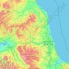
North East England
North East England has a Marine west coast climate (generally found along the west coast of middle latitude continents) with narrower temperature ranges than the south of England and sufficient precipitation in all months. Summers and winters are mild rather than extremely hot or cold, due to the strong…
Average elevation: 165 m

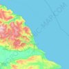
Scarborough
United Kingdom > England > North Yorkshire
The climate is temperate with mild summers and cool, windy, winters. The hottest months of the year are July and August, with temperatures reaching an average high of 17 °C and falling to 11 °C at night. The average daytime temperatures in January are 4 °C, falling to 1 °C at night. The station's elevation…
Average elevation: 50 m
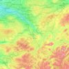

Newark on Trent
United Kingdom > England > Nottinghamshire > Newark and Sherwood
Average elevation: 18 m








Putney
Putney Heath is around 400 acres (160 hectares) less the nascent A3 road in size and rises to 45 metres (148 ft) above sea level. Because of its elevation, from 1796 to 1816 Putney Heath hosted a station in the shutter telegraph chain, which connected the Admiralty in London to its naval ships in Portsmouth.…
Average elevation: 18 m


North York Moors National Park
United Kingdom > England > North Yorkshire
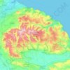
As part of the United Kingdom, the North York Moors area generally has warm summers and relatively mild winters. Weather conditions vary from day to day as well as from season to season. The latitude of the area means that it is influenced by predominantly westerly winds with depressions and their associated…
Average elevation: 110 m


River Wye
The River Wye is protected by two Sites of Special Scientific Interest, one covering the Upper Wye (Gwy Uchaf) above Hay-on-Wye, and one covering the Lower Wye (Gwy Isaf) downstream to Chepstow. The criteria for inclusion of the river as an SSSI include geology, topography, flora, mammals, invertebrates, fish…
Average elevation: 207 m


Willesley
United Kingdom > England > Leicestershire > North West Leicestershire
Average elevation: 110 m


Bollitree Castle
United Kingdom > England > Herefordshire > Weston under Penyard
Average elevation: 87 m


Willen Lake
United Kingdom > England > City of Milton Keynes > Milton Keynes > Monkston
Average elevation: 67 m



Stow-on-the-Wold
United Kingdom > England > Gloucestershire > Cotswold District
Average elevation: 163 m

Plymouth
United Kingdom > England > Devon > Plymouth
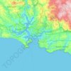
The River Plym, which flows off Dartmoor to the north-east, forms a smaller estuary to the east of the city called Cattewater. Plymouth Sound is protected from the sea by the Plymouth Breakwater, in use since 1814. In the Sound is Drake's Island which is seen from Plymouth Hoe, a flat public area on top of…
Average elevation: 81 m



Gateshead
United Kingdom > England > Tyne and Wear > Gateshead
One of the most distinguishing features of Gateshead is its topography. The land rises 230 feet (70 m) from Gateshead Quays to the town centre and continues rising to a height of 525 feet (160 m) at Queen Elizabeth Hospital in Sheriff Hill. This is in contrast to the flat and low lying Team Valley located on…
Average elevation: 62 m


Weston-super-Mare
United Kingdom > England > North Somerset > Weston-super-Mare
Average elevation: 13 m


Welshpool
United Kingdom > Wales > Powys
The Mermaid Inn, 28 High Street, was very probably an early 16th-century merchant's house, placed on a burgage plot between the High Street and Alfred Jones Court. The timber-framed building has long storehouse or wing to the rear. The frontage was remodelled c. 1890, by Frank H. Shayler, architect, of…
Average elevation: 156 m