Geolocate

Thistleboon topographic map

Click on the map to display elevation.

About this map

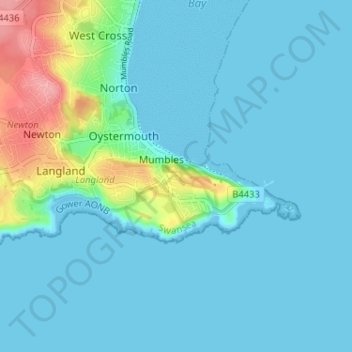
Name: Thistleboon topographic map, elevation, terrain.

Location: Thistleboon, Mumbles, Swansea, Wales, SA3 4HY, United Kingdom (51.55050 -4.01172 51.59050 -3.97172)

Average elevation: 16 m

Minimum elevation: 0 m

Maximum elevation: 101 m

Other topographic maps

Click on a map to view its topography, its elevation and its terrain.

Swansea Bay

United Kingdom > Wales > Swansea > Mumbles

Average elevation: 25 m

Gear up for your next adventure:

💡LED Headlamp - Hands-free illumination for night hiking and camping
👟Leg Gaiters - Keep debris, mud, and snow out of your boots
🏃Hydration Running Vest - Carry water and maps close to your body for speed
👖Convertible Hiking Pants - Zip-off legs to adapt to changing weather conditions
🚲Bike Repair Kit - Essential tools for on-trail mechanical issues

As an Amazon Associate, this site earns from qualifying purchases at no extra cost to you.