Geolocate

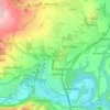
Rossett topographic map

Click on the map to display elevation.

About this map

Name: Rossett topographic map, elevation, terrain.

Location: Rossett, Wrexham, Wales, LL12 0DE, United Kingdom (53.08962 -2.96491 53.12962 -2.92491)

Average elevation: 20 m

Minimum elevation: 4 m

Maximum elevation: 78 m

Other topographic maps

Click on a map to view its topography, its elevation and its terrain.
Bangor-on-Dee

United Kingdom > Wales > Wrexham

Average elevation: 30 m

Cefn

United Kingdom > Wales > Wrexham > Acrefair

Average elevation: 142 m

Gwersyllt

United Kingdom > Wales > Wrexham

Average elevation: 112 m

Penycae

United Kingdom > Wales > Wrexham

Average elevation: 350 m

Rhosddu

United Kingdom > Wales > Wrexham

Average elevation: 88 m

Ceiriog Ucha

United Kingdom > Wales > Wrexham

Average elevation: 420 m

Gear up for your next adventure:

🥫Freeze-Dried Meals - Lightweight, high-calorie nutrition for multi-day treks
🥾Durable Hiking Shoes - Long-lasting shoes for frequent hiking
🧰Multitool Knife - Compact and versatile tool for outdoor use
🧢Sun Protection Cap - Breathable cap to protect from sun exposure
🧦Hiking Socks - Moisture-wicking and comfortable socks for long hikes

As an Amazon Associate, this site earns from qualifying purchases at no extra cost to you.