Geolocate

Caerleon topographic map

Click on the map to display elevation.

About this map
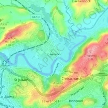
Name: Caerleon topographic map, elevation, terrain.

Location: Caerleon, Newport, Gwent, Wales, NP18 1AE, United Kingdom (51.58947 -2.97410 51.62947 -2.93410)

Average elevation: 37 m

Minimum elevation: -2 m

Maximum elevation: 116 m

Gear up for your next adventure:

🐕Hiking Dog Pack - Let your canine companion carry their own water and food
🥾Mountain Hiking Shoes - Shoes with superior grip for mountainous terrain
🛌Insulated Sleeping Pad - Critical thermal barrier between you and the cold ground
🧭Orienteering Kit - Tools for map reading and navigation in the wild
🧥Softshell Jacket - Windproof and breathable jacket for hiking

As an Amazon Associate, this site earns from qualifying purchases at no extra cost to you.