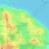
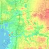
Sarasota County topographic map
Click on the map to display elevation.
About this map

Name: Sarasota County topographic map, elevation, terrain.
Location: Sarasota County, Florida, United States, Plantation (27.04973 -82.38143 27.07901 -82.35212)
Average elevation: 6 m
Minimum elevation: 2 m
Maximum elevation: 9 m
Other topographic maps
Click on a map to view its topography, its elevation and its terrain.


Ormond Beach
United States > Florida > Volusia County > Ormond Beach > Ormond Beach
Average elevation: 4 m


Florida Keys
United States > Florida > Monroe County
The Florida Keys, an archipelago extending about 120 miles from the southeastern tip of Florida, feature a unique topography characterized by low-lying coral islands and a series of intricate waterways. Most islands are less than 5 feet above sea level, contributing to their vulnerability to storm surges and…
Average elevation: 0 m





Hudson
United States > Florida > Hudson
Hudson features a predominantly flat and low-lying topography typical of the region, with an average elevation of approximately 16 feet above sea level. This terrain is interspersed with various wetlands and small lakes, creating a rich ecosystem that supports diverse wildlife. The area also includes a few…
Average elevation: 5 m


Vero Beach
United States > Florida > Indian River County > Vero Beach > Vero Beach
Average elevation: 7 m













Key West
United States > Florida > Monroe County > Key West > Key West
Key West is an island located at 24°33′55″N 81°46′33″W / 24.565176°N 81.775794°W / 24.565176; -81.775794 in the Straits of Florida. The island is about 4 miles (6 km) long and 1 mile (2 km) wide, with a total land area of 4.2 square miles (10.9 km2; 2,688.0 acres). The average elevation…
Average elevation: 1 m



Miami
United States > Florida > Miami-Dade County
Miami and its suburbs are located on a broad plain between the Everglades to the west and Biscayne Bay to the east, which extends from Lake Okeechobee southward to Florida Bay. The elevation of the area averages at around 6 ft (1.8 m) above sea level in most neighborhoods, especially near the coast. The…
Average elevation: 4 m

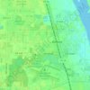




Pompano Beach Highlands
United States > Florida > Broward County > Pompano Beach
Average elevation: 7 m

San Mateo
United States > Florida > Putnam County
San Mateo is located at 29°36′25″N 81°35′06″W / 29.607°N 81.585°W / 29.607; -81.585, with an elevation of 72 feet (22 m).
Average elevation: 10 m






Halifax Estates
United States > Florida > Volusia County > Daytona Beach Shores
Average elevation: 1 m













South Fork New River
United States > Florida > Broward County > Fort Lauderdale
Average elevation: 7 m