Geolocate

Pensacola topographic map

Click on the map to display elevation.

About this map

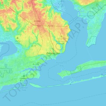
Name: Pensacola topographic map, elevation, terrain.

Location: Pensacola, Escambia County, Florida, 32501, United States (30.26131 -87.37691 30.58131 -87.05691)

Average elevation: 9 m

Minimum elevation: -4 m

Maximum elevation: 57 m

Gear up for your next adventure:

🥾Waterproof Trail Shoes - Shoes designed to handle wet terrain
🦟Insect Repellent - Keep mosquitoes and black flies away in wooded areas
🛏️Sleeping Bag - Warm and compact sleeping bags for outdoor camping
🎒Backpack Rain Cover - External shield to keep your entire pack dry
🥾Approach Shoes - Shoes designed for climbing approaches and rugged trails

As an Amazon Associate, this site earns from qualifying purchases at no extra cost to you.