Geolocate

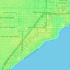
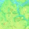
Bayside East topographic map

Click on the map to display elevation.

About this map

Name: Bayside East topographic map, elevation, terrain.

Location: Bayside East, Hillsborough County, Florida, 33615, United States (27.97421 -82.61681 28.01421 -82.57681)

Average elevation: 4 m

Minimum elevation: -1 m

Maximum elevation: 10 m

Other topographic maps

Click on a map to view its topography, its elevation and its terrain.
Lutz

United States > Florida > Hillsborough County

Average elevation: 21 m

Lake Park

United States > Florida > Hillsborough County > Lutz

Average elevation: 19 m

Boyette

United States > Florida > Hillsborough County > Boyette

Average elevation: 21 m

Cheval

United States > Florida > Hillsborough County

Average elevation: 20 m

Gear up for your next adventure:

🛁Quick-Dry Microfiber Towel - Space-saving towel that dries rapidly on the move
🔦LED Headlamp - Hands-free lighting for early morning starts or late finishes
🚲MTB Frame Bag - Carry tools and maps directly on your bicycle frame
🔋Emergency Crank Radio - Weather alerts and power without needing batteries
⛺Lightweight Backpacking Tent - Compact tent for efficient hiking trips

As an Amazon Associate, this site earns from qualifying purchases at no extra cost to you.