Geolocate

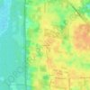
Halifax River topographic map

Click on the map to display elevation.

About this map

Name: Halifax River topographic map, elevation, terrain.

Location: Halifax River, Volusia County, Florida, 32115, United States (29.22256 -81.01898 29.22265 -81.01895)

Average elevation: 4 m

Minimum elevation: -2 m

Maximum elevation: 15 m

Other topographic maps

Click on a map to view its topography, its elevation and its terrain.
Enterprise

United States > Florida > Volusia County

Average elevation: 7 m

Riverside

United States > Florida > Volusia County > DeLand

Average elevation: 6 m

Barberville

United States > Florida > Volusia County

Average elevation: 12 m

Glenwood

United States > Florida > Volusia County > DeLand

Average elevation: 21 m

Deltona

United States > Florida > Volusia County > Deltona

Average elevation: 12 m

Daisy Lake

United States > Florida > Volusia County

Average elevation: 6 m

Pierson

United States > Florida > Volusia County

Average elevation: 14 m

Alamana

United States > Florida > Volusia County

Average elevation: 11 m

Gear up for your next adventure:

👖Convertible Hiking Pants - Zip-off legs to adapt to changing weather conditions
👟Sport Hiking Sandals - Breathable footwear for water crossings and camp rest
🦌Outdoor Trail Camera - Monitor wildlife activity near your favorite spots
🧥Packable Rain Jacket - Breathable waterproof layer for unpredictable weather
🥾Lightweight Hiking Boots - Boots for comfort and mobility on long hikes

As an Amazon Associate, this site earns from qualifying purchases at no extra cost to you.