
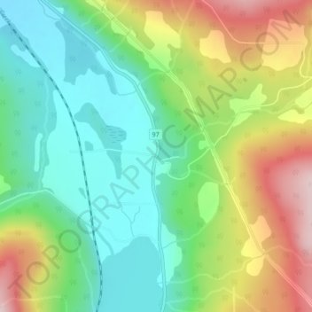
Monte Lake topographic map
Click on the map to display elevation.
About this map
Name: Monte Lake topographic map, elevation, terrain.
Average elevation: 790 m
Minimum elevation: 665 m
Maximum elevation: 1,003 m
British Columbia trails, hiking, mountain biking, running and outdoor activities
Other topographic maps
Click on a map to view its topography, its elevation and its terrain.
Vancouver
Canada > British Columbia > Metro Vancouver Regional District
Vancouver, British Columbia, is situated on the Burrard Peninsula, bordered by Burrard Inlet to the north and the Fraser River to the south. The city's topography is a blend of flat and hilly terrains, with elevations ranging from sea level to approximately 152 meters (500 feet) above sea level. The North…
Average elevation: 34 m
Victoria
Canada > British Columbia > Capital Regional District
Victoria, British Columbia, is situated on the southern tip of Vancouver Island, Canada, and boasts a diverse and varied topography. The city is characterized by rolling hills, rugged coastal cliffs, and lush valleys, providing a striking contrast between mountainous terrain and flatland areas. To the north…
Average elevation: 17 m
Burnaby
Canada > British Columbia > Metro Vancouver Regional District
Burnaby occupies 98.6 square kilometres (38.1 sq mi) and is located at the geographic centre of the Metro Vancouver Regional District. The regional district's government is located in Burnaby's Metrotown area. Situated between the city of Vancouver on the west and Port Moody, Coquitlam, and New Westminster on…
Average elevation: 59 m
Vancouver Island
The rain shadow effect of the island's mountains, as well as the mountains of Washington's Olympic Peninsula, creates wide variation in precipitation. The west coast is considerably wetter than the east coast. Average annual precipitation ranges from 6,650 mm (262 in) at Hucuktlis Lake on the west coast…
Average elevation: 411 m
Kelowna
Canada > British Columbia > Regional District of Central Okanagan
Kelowna is classified as a humid continental climate or an inland oceanic climate per the Köppen climate classification system due to its coldest month having an average temperature slightly above −3.0 °C (26.6 °F) and below 0 °C (32 °F), with dry, hot, sunny summers and cool, cloudy winters, and four…
Average elevation: 704 m
Coquitlam
Canada > British Columbia > Metro Vancouver Regional District
Like much of Metro Vancouver, Coquitlam has an oceanic climate (Köppen climate type Cfb), experiencing mild temperatures and high precipitation; warm, dry summers and cool, wet winters. However, compared to most other cities in the area, precipitation is especially heavy in Coquitlam due to its proximity to…
Average elevation: 190 m
Prince George
Canada > British Columbia > Regional District of Fraser-Fort George
The area has a humid continental climate (Köppen climate classification Dfb, Trewartha Dclo), but is close to (and once had) a subarctic climate (Dfc) as May and September averages are both close to the 10 °C (50 °F) threshold. Winters are milder than the latitude and elevation might suggest: the January…
Average elevation: 685 m
Area A (Boston Bar/North Bend/Canyon Alpine)
Canada > British Columbia > Fraser Valley Regional District
Average elevation: 1,260 m
West Kelowna
Canada > British Columbia > Regional District of Central Okanagan
Average elevation: 649 m
Revelstoke
Canada > British Columbia > Columbia-Shuswap Regional District
A small ski resort featuring a single short lift has operated on Mount MacKenzie since the 1960s, and snowcat skiing was offered for higher altitudes. A strong movement pushed to expand the entire mountain into a single resort, and construction started in the early 2000s (decade).
Average elevation: 982 m
Mission
Canada > British Columbia > Fraser Valley Regional District
The western part of the district, the Stave Valley, is largely rural and forested but its watercourse is home to what was the largest hydroelectric project in British Columbia until the Bridge River Power Project opened in 1961. It was built by the British Columbia Electric Railway (BCER) to provide power to…
Average elevation: 345 m
Tunkwa Lake
Canada > British Columbia > Thompson-Nicola Regional District > Area J (Copper Desert Country)
Average elevation: 1,161 m
Vargas Island
Canada > British Columbia > Alberni-Clayoquot Regional District > Area C (Long Beach)
Average elevation: 11 m
Keremeos
Canada > British Columbia > Regional District of Okanagan-Similkameen
Average elevation: 441 m
Okanagan Lake
Canada > British Columbia > Regional District of Central Okanagan > Kelowna
Average elevation: 1,194 m
Vancouver
Canada > British Columbia > Metro Vancouver Regional District
Vancouver, British Columbia, is situated on the Burrard Peninsula, bordered by Burrard Inlet to the north and the Fraser River to the south. The city's topography is a blend of flat and hilly terrains, with elevations ranging from sea level to approximately 152 meters (500 feet) above sea level. The North…
Average elevation: 34 m
Bowen Island
Canada > British Columbia > Metro Vancouver Regional District > Bowen Island Municipality
Average elevation: 106 m
Kimberley
Canada > British Columbia > Regional District of East Kootenay
Kimberley has a continental climate with semi-arid influences and heavy moderation from the nearby mountains which tend to block arctic air masses, and produce a rain shadow. Its fairly high elevation counters this effect slightly, as temperatures are somewhat cooler and the town slightly more rainy than it…
Average elevation: 1,216 m
Shuswap Lake
Canada > British Columbia > Columbia-Shuswap Regional District > Area F (Scotch Creek/Seymour Arm)
Average elevation: 1,064 m
Township of Langley
Canada > British Columbia > Metro Vancouver Regional District
Average elevation: 47 m
Chilliwack Lake
Canada > British Columbia > Fraser Valley Regional District > Area E (Chilliwack River Valley)
Average elevation: 1,152 m
Saturna Island
Canada > British Columbia > Capital Regional District > Southern Gulf Islands Electoral Area
Average elevation: 34 m
Penticton
Canada > British Columbia > Regional District of Okanagan-Similkameen
Penticton is located at the geographical coordinates of 49°29′28″N 119°35′19″W / 49.49111°N 119.58861°W / 49.49111; -119.58861 (Penticton) and covers an area of 42.10 km2 (16.25 sq mi), with a maximum north–south distance of 7 km (4.3 mi) wide between the Okanagan Lake to the north…
Average elevation: 702 m
Prince Rupert
Canada > British Columbia > North Coast Regional District
Prince Rupert Airport (YPR/CYPR) is on Digby Island. Its position is 54°17′10″N 130°26′41″W / 54.28611°N 130.44472°W / 54.28611; -130.44472, and its elevation is 35 m (116 ft) above sea level. The airport consists of one runway, one passenger terminal, and two aircraft stands. Access to…
Average elevation: 91 m
Hornby Island
Canada > British Columbia > Comox Valley Regional District > Area A (Baynes Sound)
Average elevation: 27 m
Osoyoos
Canada > British Columbia > Regional District of Okanagan-Similkameen
Average elevation: 326 m
Quadra Island
Canada > British Columbia > Strathcona Regional District > Area B (Discovery Islands/Mainland Inlets)
Average elevation: 128 m
Saltspring Island
Canada > British Columbia > Capital Regional District > Salt Spring Island Electoral Area
Average elevation: 72 m
Cultus Lake
Canada > British Columbia > Fraser Valley Regional District > Area H (Cultus Lake/Columbia Valley) > Cultus Lake
Average elevation: 191 m
Woodlot 0007
Canada > British Columbia > Metro Vancouver Regional District > Maple Ridge
Average elevation: 322 m
Radium Hot Springs
Canada > British Columbia > Regional District of East Kootenay
Average elevation: 912 m
Bute Inlet
Canada > British Columbia > Strathcona Regional District > Area B (Discovery Islands/Mainland Inlets)
The Bute Inlet route was later considered for the mainline of the Canadian Pacific Railway (CPR), which would have seen extensive blasting down the west shore of the inlet and a series of bridges to reach Vancouver Island near Campbell River via Seymour Narrows. This route was passed over in favour of the…
Average elevation: 921 m
Piers Island
Canada > British Columbia > Capital Regional District > Southern Gulf Islands Electoral Area
Average elevation: 4 m
Pacific Spirit Regional Park
Canada > British Columbia > Metro Vancouver Regional District > Electoral Area A
Average elevation: 56 m
Thetis Lake
Canada > British Columbia > Capital Regional District > View Royal
Average elevation: 71 m
Wasley Lake
Canada > British Columbia > Thompson-Nicola Regional District > Area M (Beautiful Nicola Valley - North)
Average elevation: 1,291 m
West End
Canada > British Columbia > Metro Vancouver Regional District > Vancouver
Average elevation: 15 m
Skaha Lake
Canada > British Columbia > Regional District of Okanagan-Similkameen > Area I (Skaha West/Kaleden/Apex) > Kaleden
Average elevation: 701 m
Jim Smith Lake
Canada > British Columbia > Regional District of East Kootenay > Area C (Moyie/Bull River)
Average elevation: 1,091 m
Hydraulic Lake
Canada > British Columbia > Regional District of Central Okanagan > East Central Okanagan Electoral Area
Average elevation: 1,266 m
Bonaparte Lake
Canada > British Columbia > Thompson-Nicola Regional District > Area O (Lower North Thompson)
Average elevation: 1,383 m
Grandview-Woodland
Canada > British Columbia > Metro Vancouver Regional District > Vancouver
Average elevation: 28 m
Banks Island
Canada > British Columbia > North Coast Regional District
Banks Island is an island on the coast of the Canadian province of British Columbia, it is 72 kilometres (45 mi) long, and ranges in width from 9.7 kilometres (6.0 mi) to 18 kilometres (11 mi). The island is 1,005 square kilometres (388 sq mi) in area, and reaches 536 metres (1,759 ft) in elevation.
Average elevation: 70 m
Salmon Glacier
Canada > British Columbia > Regional District of Kitimat-Stikine > Stewart
Average elevation: 1,557 m