Geolocate

Kosli topographic map

Click on the map to display elevation.

About this map

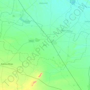
Name: Kosli topographic map, elevation, terrain.

Location: Kosli, Rewari District, Haryana, India (28.31205 76.27982 28.47241 76.61149)

Average elevation: 235 m

Minimum elevation: 211 m

Maximum elevation: 345 m

Other topographic maps

Click on a map to view its topography, its elevation and its terrain.

Hodal

India > Haryana > Hodal

Hodal is a town and a municipal council, located, on Palwal Road in Palwal district in the Haryana state of India.It is Part of Braj region. Its language is Braj bhasha & Haryanvi. It is located at 27°53′39″N 77°22′09″E / 27.89417°N 77.36917°E / 27.89417; 77.36917 and has an average…

Average elevation: 190 m

Phidedi

India > Haryana > Rewari

Average elevation: 241 m

Seekri

India > Haryana > Ballabgarh

Average elevation: 196 m

Ambala

India > Haryana > Ambala Cantt

Average elevation: 275 m

Badhra

India > Haryana > Badhra

Average elevation: 256 m

Hathin

India > Haryana > Hathin

Average elevation: 193 m

Payaga

India > Haryana > Mahendragarh

Average elevation: 272 m

Kakru

India > Haryana > Ambala Cantt

Average elevation: 275 m

Ateli Mandi

India > Haryana > Narnaul

Average elevation: 288 m

Titram

India > Haryana > Kaithal

Average elevation: 236 m

Taoru

India > Haryana > Taoru

Average elevation: 265 m

Punhana

India > Haryana > Punahana

Average elevation: 189 m

Nuh

India > Haryana > Nuh

Average elevation: 205 m

Ladwa

India > Haryana > Ladwa

Average elevation: 264 m

Pehowa

India > Haryana > Pehowa

Pehowa is located at 29°59′N 76°35′E / 29.98°N 76.58°E / 29.98; 76.58. It has an average elevation of 224 metres (734 feet). The Tehsil Pehowa was created on 1 November 1979 and is situated at a distance of 27 km in west from Kurukshetra. and 26 km North-west from Pundri

Average elevation: 246 m

Feroj Pur

India > Haryana > Hathin

Average elevation: 193 m

Bhankri village

India > Haryana > Faridabad

Average elevation: 219 m

SECTOR 79

India > Haryana > Faridabad

Average elevation: 202 m

Safidon

India > Haryana > Safidon

The elevation of Safidon is about 221 m (725 ft) above sea level. The fertile land of Safidon paves the way for the growth of crops such as wheat, paddy, sugarcane, millets, pulses, vegetables and fruits; accompanied by well developed irrigation facilities. The groundwater of some villages like Anta, Rampura,…

Average elevation: 235 m

Faridabad

India > Haryana > Faridabad

Average elevation: 217 m

Narnaul

India > Haryana > Narnaul > Narnaul

Narnaul is located at 28°02′N 76°07′E / 28.04°N 76.11°E / 28.04; 76.11. It has an average elevation of 300 meters (977 feet). The district is rich in mineral resources such as iron ore, copper ore, beryl, tourmaline, muscovite, biotite, albite, calcite, and quartz.

Average elevation: 318 m

Raipur Rani

India > Haryana > Raipur Rani > Raipur Rani

Average elevation: 337 m

Kundli

India > Haryana > Sonipat > Kundli

Average elevation: 213 m

Rohtak

India > Haryana > Rohtak > Rohtak

Average elevation: 222 m

Kalanaur

India > Haryana > Kalanaur > Kalanaur

Average elevation: 220 m

Shahbad

India > Haryana > Shahbad

Average elevation: 265 m

Mewala Maharajpur

India > Haryana > Faridabad > Faridabad

Average elevation: 213 m

Sonipat

India > Haryana > Sonipat

Average elevation: 222 m

Rakhigarhi

India > Haryana > Narnaund

Average elevation: 221 m

Lapra

India > Haryana > Jagadhri

Average elevation: 271 m

Gear up for your next adventure:

🚑Survival Whistle - Signal for help across long distances in mountains
🔥Camping Stove - Portable stoves to cook outdoors with ease
🔦LED Flashlight - Powerful and long-lasting flashlight for camping and emergencies
🦶Anti-Blister Balm - Prevents friction and hotspots during long ascents
🔭Compact Monocular - One-handed bird watching and trail spotting

As an Amazon Associate, this site earns from qualifying purchases at no extra cost to you.