Geolocate

Taoru topographic map

Click on the map to display elevation.

About this map

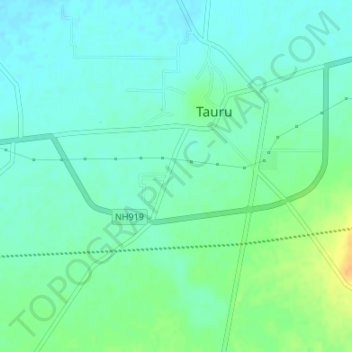
Name: Taoru topographic map, elevation, terrain.

Location: Taoru, Nuh District, Haryana, India (28.19078 76.93009 28.22030 76.96359)

Average elevation: 265 m

Minimum elevation: 255 m

Maximum elevation: 287 m

Gear up for your next adventure:

🥾Lightweight Hiking Boots - Boots for comfort and mobility on long hikes
🧦Thermal Socks - Warm socks for winter hiking or camping
🌡️Emergency Mylar Blankets - Compact thermal protection for unexpected nights outdoors
🥾Waterproof Hiking Shoes - Durable shoes for wet and rugged trails
🥾All-Terrain Hiking Boots - Versatile boots for varied hiking conditions

As an Amazon Associate, this site earns from qualifying purchases at no extra cost to you.