Geolocate

Feroj Pur topographic map

Click on the map to display elevation.

About this map

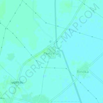
Name: Feroj Pur topographic map, elevation, terrain.

Location: Feroj Pur, Hathin, Palwal District, Haryana, India (28.05665 77.24022 28.06013 77.24452)

Average elevation: 193 m

Minimum elevation: 191 m

Maximum elevation: 196 m

Gear up for your next adventure:

🧥Fleece Jacket - Warm and lightweight jacket for layering
🥾Trail Running Shoes - Lightweight and durable shoes for trail running
🪑Insulated Seat Pad - Protect your seat from cold rocks and wet logs
🔦UV Flashlight - Detect minerals or specific insects in the dark
🥘Camping Cookware Set - Compact nesting pots and pans for trail cooking

As an Amazon Associate, this site earns from qualifying purchases at no extra cost to you.