Geolocate

Titram topographic map

Click on the map to display elevation.

About this map

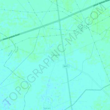
Name: Titram topographic map, elevation, terrain.

Location: Titram, Kaithal, Kaithal District, Haryana, India (29.69877 76.38272 29.73877 76.42272)

Average elevation: 236 m

Minimum elevation: 233 m

Maximum elevation: 238 m

Gear up for your next adventure:

🔨Vehicle Emergency Tool - Safety tool for remote road trips to trailheads
🧰Emergency Multi-Tool - Compact multi-tool for outdoor survival
Lightweight Backpacking Tent - Compact tent for efficient hiking trips
🥾Waterproof Trail Shoes - Shoes designed to handle wet terrain
🥘Camping Cookware Set - Compact nesting pots and pans for trail cooking

As an Amazon Associate, this site earns from qualifying purchases at no extra cost to you.