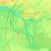
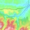
Palencia topographic map
Click on the map to display elevation.
Palencia
The region of Palencia has a Continental Mediterranean climate with cool winters, due to altitude (749 m) and isolation from maritime influences, chilly winds, including some days of snow in the winter and minimum temperatures usually below 0 °C (32 °F). Fog is frequent because of the Carrion river. Summers are hot with temperatures that consistently surpass 30 °C (86 °F) in July and that can rarely reach 38 °C (99 °F). Due to Palencia's altitude, nightly temperatures tend to be cooler, leading to a lower average in the summer months. Precipitation levels are moderated, but precipitation can be observed throughout the year (except July and August). Summer and winter are the driest seasons, with most rainfall occurring in the autumn and spring.
About this map
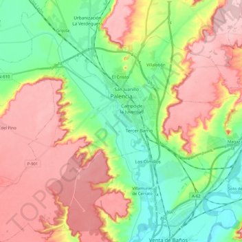
Name: Palencia topographic map, elevation, terrain.
Location: Palencia, Castile and León, Spain (41.91943 -4.65434 42.07121 -4.48177)
Average elevation: 794 m
Minimum elevation: 712 m
Maximum elevation: 889 m
Other topographic maps
Click on a map to view its topography, its elevation and its terrain.








Monte Bernorio
Spain > Castile and León > Pomar de Valdivia
The Monte Bernorio is an elevation located next to the town of Villarén de Valdivia, in the north of the province of Palencia (Spain) where important archaeological remains have been found, as well as the remains of a fortified Cantabrian city, which exceeds 120 ha and is one of the largest found in Spain and…
Average elevation: 1,017 m




Valtuille de Abajo
Spain > Castile and León > El Bierzo > Villafranca del Bierzo
Average elevation: 525 m


Ávila
Ávila is the capital and most populated municipality of the Province of Ávila, located in the autonomous community of Castile and León in Spain. Located in the centre of the Iberian Peninsula, to the north of the Sistema Central, it lies on the right bank of the Adaja and, at an elevation of over 1,130…
Average elevation: 1,167 m




Sierra de Guadarrama
The range runs southwest–northeast, extending from the province of Ávila in the southwest, through the Community of Madrid, to the province of Segovia in the northeast. The range measures approximately 80 kilometres (50 mi) in length. Its highest peak is Peñalara, 2,428 metres (7,966 ft) in elevation.
Average elevation: 1,153 m
Yacimiento arqueológico La Edrada
Spain > Castile and León > El Bierzo > Cacabelos
Average elevation: 493 m
Poblado del Salto de Aldeadávila
Spain > Castile and León > Aldeadávila de la Ribera
Average elevation: 535 m