

United States topographic maps
Click on a map to view its topography, its elevation and its terrain.
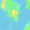


Lake Wylie
United States > South Carolina > Lake Wylie
Lake Wylie is located on a peninsula along the shore of Lake Wylie in the Piedmont of both North and South Carolina, at 35°6′22″N 81°3′25″W / 35.10611°N 81.05694°W / 35.10611; -81.05694 (35.105973, -81.056978). According to the United States Census Bureau, the CDP has a total area of 4.7…
Average elevation: 188 m

Baltimore County
According to the United States Census Bureau, the county covers 682 square miles (1,770 km2), of which 598 square miles (1,550 km2) are land and 83 square miles (210 km2) (12%) are water. It is the third-largest county in Maryland by land area. The larger portion of the terrain is undulating, with bold hills…
Average elevation: 123 m

Saint Louis County
The foothills of the Ozark Mountains begin in southwestern St. Louis County, with most of the rest of the county being a fairly level plateau. This western part of the county is the least developed, due to rugged topography. Bluffs along the Mississippi in the south of the county rise about 200–300 feet…
Average elevation: 166 m
Little Saint James Island
United States > United States Virgin Islands > Saint Thomas - Saint John District
Average elevation: 1 m

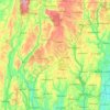
Litchfield County
United States > Connecticut > Northwest Hills Planning Region
Average elevation: 252 m

Martinsville
United States > Virginia > Martinsville
According to the United States Census Bureau, the city has a total area of 11.0 square miles (28.5 km2), of which 11.0 square miles (28.5 km2) is land and 0.1 square miles (0.3 km2) (0.5%) is water. The north side of the city has the highest average elevation. The east side slopes gradually down to the Smith…
Average elevation: 259 m
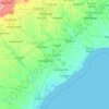
South Carolina
South Carolina's topography is defined by three major geographic regions: the Atlantic Coastal Plain, the Piedmont, and the Blue Ridge Mountains. Covering approximately two-thirds of the state, the Atlantic Coastal Plain is characterized by flat, gently rolling terrain that transitions from the sandy beaches…
Average elevation: 85 m

Southern California
Southern California presents a highly varied and tectonically shaped topography, where Pacific coastal plains and urban basins rise abruptly into rugged mountain ranges before descending toward broad inland deserts. Its relief is organized by the east–west Transverse Ranges, including the San Gabriel and San…
Average elevation: 579 m

East Tennessee
East Tennessee occupies one of the most rugged and varied parts of the southern Appalachians, where the landscape steps from the deeply dissected Cumberland Plateau in the west into the long, parallel ridges and valleys of the Appalachian Valley and Ridge, then rises sharply into the Blue Ridge and Great Smoky…
Average elevation: 435 m
Joshua Tree National Park
United States > California > Riverside County
Joshua Tree National Park is an American national park in southeastern California, east of San Bernardino and Los Angeles and north of Palm Springs. It is named after the Joshua trees (Yucca brevifolia) native to the Mojave Desert. Originally declared a national monument in 1936, Joshua Tree was redesignated…
Average elevation: 639 m

Mendenhall Glacier
United States > Alaska > Juneau
The two small parking lots have access to several trails in the area. Photo Point Trail and the Steep Creek Trail are easy and accessible trails. Elevated boardwalks above Steep Creek provide salmon and bear viewing opportunities. Visitors can hike via the East Glacier Loop to an overlook within 1 mile (1,600…
Average elevation: 974 m

Fort Wayne
United States > Indiana > Allen County
Pioneer newspaperman George W. Wood was elected the city's first mayor. Fort Wayne's "Summit City" nickname dates from this period, referring to the city's position at the highest elevation along the canal's route. As influential as the canal was to the city's earliest development, it quickly became obsolete…
Average elevation: 246 m


Albuquerque
United States > New Mexico > Bernalillo County
Albuquerque is located in north-central New Mexico. To its east are the Sandia–Manzano Mountains. The Rio Grande flows north to south through its center, while the West Mesa and Petroglyph National Monument make up the western part of the city. Albuquerque has one of the highest elevations of any major city…
Average elevation: 1,688 m
Missouri
North of, and in some cases just south of, the Missouri River lie the Northern Plains that stretch into Iowa, Nebraska, and Kansas. Here, rolling hills remain from the glaciation that once extended from the Canadian Shield to the Missouri River. Missouri has many large river bluffs along the Mississippi,…
Average elevation: 252 m

Dillon Reservoir
United States > Colorado > Summit County > Dillon
Dillon Reservoir has a popular 18 miles (29 km) paved bike path that winds around the entire reservoir. The path can be accessed at any point around the reservoir. Starting in Frisco and going clockwise, it goes behind the Summit Middle School, marshlands, and continues across the Dam road. It passes the towns…
Average elevation: 2,808 m

Salem
United States > Oregon > Marion County
Elevation within the city limits ranges from about 120 to 800 feet (37 to 244 m). Salem contains the volcanic Salem Hills in the south and is sandwiched by the 1,000 ft (300 m) Eola Hills directly to the west and the 600 ft (180 m) Waldo Hills to the east. Northern and eastern Salem are less hilly. South and…
Average elevation: 96 m
Monument Valley
United States > Arizona > Navajo County
The area is part of the Colorado Plateau. The elevation of the valley floor ranges from 5,000 to 6,000 feet (1,500 to 1,800 m) above sea level. The floor is largely siltstone of the Cutler Group, or sand derived from it, deposited by the meandering rivers that carved the valley. The valley's vivid red color…
Average elevation: 1,675 m
West Jefferson
United States > North Carolina > Ashe County
West Jefferson is a popular destination among tourists and retirees from Florida, as well as those from the lower elevations of the Carolinas and Georgia.
Average elevation: 1,002 m


Cape Charles
United States > Virginia > Northampton County > Cape Charles
Cape Charles lies on a peninsula and is surrounded by water on three sides. The town is situated directly on the Chesapeake Bay, bordered by King's Creek to the north and Old Plantation Creek to the south. The land in town is low lying and relatively flat, with the highest point of elevation at 15 feet, and a…
Average elevation: 2 m


Atlantic Coastal Plain
United States > North Carolina > Cumberland County > Fayetteville
The province's average elevation is less than 900 meters above sea level and extends some 50 to 100 kilometers inland from the ocean. The coastal plain is normally wet, including many rivers, marsh, and swampland. It is composed primarily of sedimentary rock and unlithified sediments and is primarily used for…
Average elevation: 51 m


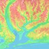


Short Hills
United States > New Jersey > Essex County > Millburn > Short Hills
Average elevation: 98 m


Santa Fe
United States > New Mexico > Santa Fe County
With a population of 87,505 at the 2020 census, it is the fourth-largest city in New Mexico. It is also the county seat of Santa Fe County. Its metropolitan area is part of the Albuquerque–Santa Fe–Las Vegas combined statistical area, which had a population of 1,162,523 in 2020. Human settlement dates back…
Average elevation: 2,221 m


Lake Almanor
United States > California > Plumas County > Lake Almanor Country Club
Average elevation: 1,474 m

Oakland Charter Township
United States > Michigan > Oakland County > Oakland Charter Township
Average elevation: 284 m


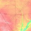
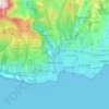

Wheeler Dam
United States > Alabama > Lauderdale County
The stretch of the Tennessee River between Decatur and Florence drops over 130 feet (40 m) in elevation, creating what was once a series of rapids known as the Muscle Shoals and the Elk River Shoals. Along with the Tennessee River Gorge to the east, these shoals had long been an impediment to river navigation,…
Average elevation: 167 m

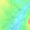
Rio Rancho
United States > New Mexico > Sandoval County
Rio Rancho is in an arid climate due to its location in the rain shadow of the Sandia Mountains to the east and the Continental Divide to the west. Rio Rancho receives 8.90 inches of precipitation annually on average. The western portion of the city receives slightly more rain and snowfall due to its higher…
Average elevation: 1,672 m


Colorado Springs
United States > Colorado > El Paso County
At 6,035 feet (1,839 m) the city stands over 1 mile (1.6 km) above sea level. Colorado Springs is near the base of Pikes Peak, which rises 14,115 feet (4,302.31 m) above sea level on the eastern edge of the Southern Rocky Mountains. The city is the largest city north of Mexico above 6000 feet in elevation.
Average elevation: 2,229 m
Kansas
The western two-thirds of the state, lying in the great central plain of the United States, has a generally flat or undulating surface, while the eastern third has many hills and forests. The land gradually rises from east to west; its altitude ranges from 684 ft (208 m) along the Verdigris River at…
Average elevation: 601 m





Grand Forks
United States > North Dakota > Grand Forks County
Grand Forks is 74 miles (119 km) north of the Fargo-Moorhead area and 145 miles (233 km) south of Winnipeg, Manitoba. Grand Forks is on the western bank of the Red River of the North in an area known as the Red River Valley. The term "forks" refers to the forking of the Red River with the Red Lake River near…
Average elevation: 255 m

Williams
United States > Arizona > Coconino County
Williams occupies a high, forested setting in northern Arizona, in the heart of the Kaibab National Forest at about 6,770 feet (2,063 m) above sea level, where broad plateau surfaces, shallow drainage corridors, and low volcanic hills give the town a gently undulating upland character. Its most prominent…
Average elevation: 2,131 m


Aurora
United States > Colorado > Adams County
Aurora's official elevation, posted on signs at the city limits, is 5,471 feet (1,668 m). However, the city spans a difference in elevation of nearly 1,000 feet (300 m). The lowest elevation of 5,285 feet (1,611 m) is found at the point where Sand Creek crosses the city limit in the northwest corner of the…
Average elevation: 1,691 m


Wrightwood
United States > California > San Bernardino County
Wrightwood is a census-designated place in San Bernardino County, California. It sits at an elevation of 6,000 feet (1,800 m). The population was 4,525 at the 2010 census, up from the population of 3,837 at the 2000 census. Wrightwood is located 77 miles (124 km) northeast of Los Angeles. Wrightwood is on the…
Average elevation: 1,959 m

Dallas
United States > Texas > Dallas County > Dallas
Dallas and its surrounding area are mostly flat. The city lies at elevations ranging from 450 to 550 feet (137 to 168 m) above sea level. The western edge of the Austin Chalk Formation, a limestone escarpment (also known as the "White Rock Escarpment"), rises 230 feet (70 m) and runs roughly north–south…
Average elevation: 158 m

Pere Marquette River
United States > Michigan > Mason County > Ludington > Buttersville
Average elevation: 180 m

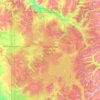
Yellowstone National Park
United States > Wyoming > Park County
Yellowstone National Park spans an area of 3,468.4 sq mi (8,983 km2), comprising lakes, canyons, rivers, and mountain ranges. Yellowstone Lake is one of the largest high-elevation lakes in North America and is centered over the Yellowstone Caldera, the largest supervolcano on the continent. The caldera is…
Average elevation: 2,450 m
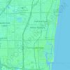


Fort Collins
United States > Colorado > Larimer County
Fort Collins is situated at the base of the Rocky Mountain foothills of the northern Front Range, approximately 60 miles (97 km) north of Denver, Colorado, and 45 miles (72 km) south of Cheyenne, Wyoming. Elevation is 4,982 ft (1,519 m) above sea level. Geographic landmarks include Horsetooth Reservoir and…
Average elevation: 1,560 m

Simpsonville
United States > South Carolina > Greenville County
Simpsonville is located in southeastern Greenville County at 34°44′0″N 82°15′36″W / 34.73333°N 82.26000°W / 34.73333; -82.26000 (34.733375, -82.260001), between Mauldin to the northwest and Fountain Inn to the southeast. The center of town has an elevation of 866 feet (264 m) above sea level.
Average elevation: 258 m


Pasadena
A portion of the Angeles Crest Highway (SR 2) in the San Gabriel Mountains cuts through Pasadena near the Angeles Crest Ranger Station. This 2-mile (3.2 km) stretch of highway in the Angeles National Forest is north of La Cañada Flintridge and west of Mount Wilson and is approximately 3,000 feet (910 m) in…
Average elevation: 550 m
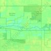


Oldsmar
United States > Florida > Pinellas County
In 1921, a hurricane hit Tampa Bay. Because Oldsmar sits on a plateau with an elevation never rising over 20 feet (6.1 m) above sea level, it was devastated by the storm. Large trees were uprooted and floodwater reached levels 14 feet (4.3 m) above normal. Some of the homes that survived the storm were moved,…
Average elevation: 6 m

Ankeny
United States > Iowa > Polk County
Like most of Polk County, Ankeny exists at the bottom area of the Des Moines Lobe, a topographical landscape area, in an area known as the Bemis Advance. The Lobe was formed during the Wisconsin glaciation leaving significant deposits resulting in an area with low relief.
Average elevation: 284 m
