Geolocate

Princeton topographic map

Click on the map to display elevation.

About this map
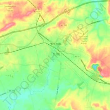
Name: Princeton topographic map, elevation, terrain.

Location: Princeton, Caldwell County, Kentucky, United States (37.06307 -87.94133 37.13885 -87.84184)

Average elevation: 155 m

Minimum elevation: 113 m

Maximum elevation: 209 m

Gear up for your next adventure:

🥘Camping Cookware Set - Compact nesting pots and pans for trail cooking
⛺Camping Groundsheet - Protect your tent from moisture and dirt
🧴First Aid Kit - Essential first aid supplies for outdoor emergencies
👟Sport Hiking Sandals - Breathable footwear for water crossings and camp rest
🥾Trail Hiking Socks - Comfortable socks to prevent blisters and fatigue

As an Amazon Associate, this site earns from qualifying purchases at no extra cost to you.