

Tennessee topographic maps
Click on a map to view its topography, its elevation and its terrain.

East Tennessee
East Tennessee occupies one of the most rugged and varied parts of the southern Appalachians, where the landscape steps from the deeply dissected Cumberland Plateau in the west into the long, parallel ridges and valleys of the Appalachian Valley and Ridge, then rises sharply into the Blue Ridge and Great Smoky…
Average elevation: 435 m

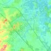


Roan Mountain
United States > Tennessee > Carter County
Roan Mountain is located in northeast Tennessee at 36°11′39″N 82°4′6″W / 36.19417°N 82.06833°W / 36.19417; -82.06833 (36.194219, -82.068417). According to the United States Census Bureau, the CDP has a total area of 6.6 square miles (17.2 km2), all land. The elevation of Roan Mountain near…
Average elevation: 926 m


Three Top Mountain;Threetop Mountain
United States > Tennessee > Cocke County
Average elevation: 766 m


Strawberry Plains Fortification
United States > Tennessee > Jefferson County > Strawberry Plains
Average elevation: 276 m

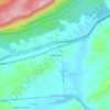

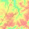

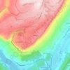





Tennessee River Pulp and Paper Company East Dam
United States > Tennessee > Hardin County
Average elevation: 129 m

